REVIEW · CHRISTCHURCH
Southern Alps Scenic
Book on Viator →Operated by Christchurch Helicopters · Bookable on Viator
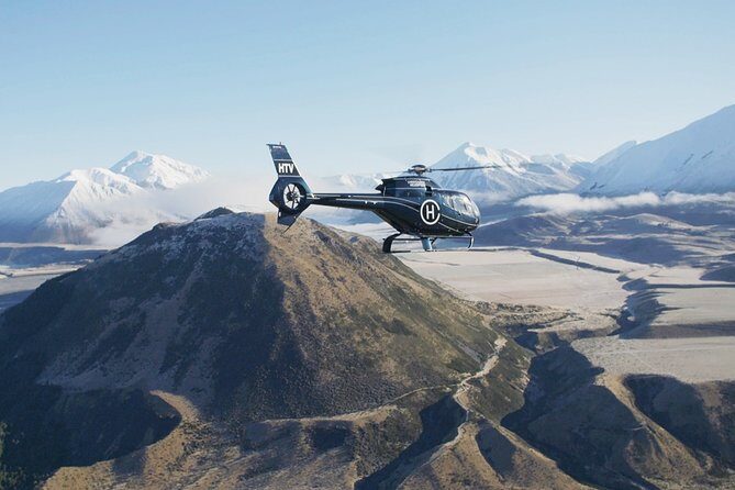
If you want Southern Alps views without the long drive, this helicopter flight hits the sweet spot. You fly from Christchurch into the Canterbury region, cross the braided Waimakariri River, and then land on Chest Peak (about 6,500 ft) for 360-degree mountain scenery and photo time.
Two things I really like: the way the pilot points out what you’re actually looking at, and the landing at the top, not just a fly-by. When I rode with the team, Jess at reception set a friendly tone, and the pilot (Scott) was steady, professional, and happy to share local stories as you went over the sites.
One consideration: this is not sold as a glacier or snow flight. If you’re booking with glacier expectations, check your exact option first.
In This Review
- Key things to know before you book
- The flight that turns Canterbury into a 360° photo set
- Who this suits best
- Meeting point and timing: plan for a calm, focused start
- Over the Waimakariri River: where braided rivers look unreal
- Castle Hill’s rockscape: the kind of scenery you understand best from above
- The Canterbury Plains to Chest Peak: you’re flying toward a 6,500 ft viewpoint
- Why that landing is such good value
- Spotting Flock Hill: sheep country shows up fast from the sky
- Top-of-mountain time: 360° views that actually pay off
- The pilot touch: Scott’s local stories add real meaning
- Price and value: what you’re really paying for
- Weather and expectations: two things that can change your experience
- Should you book Southern Alps Scenic?
- FAQ
- What is the total duration of Southern Alps Scenic?
- Where do I meet for the flight?
- Is this a private tour?
- Does the tour depend on weather?
- What can I see on the route?
- Is there a glacier included?
Key things to know before you book
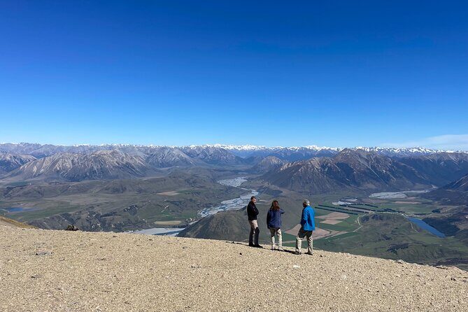
- Landing on Chest Peak: you get real time up high, not just a quick pass.
- Braided Waimakariri River views: you see the river’s channels from above where it looks like lines drawn across the valley.
- Castle Hill rock scenery: a famous rock landscape that’s much easier to understand from the air.
- Small details from the pilot: you’ll get explanations and personal stories while you fly.
- Photo-friendly 360° stop: you can walk your camera around and frame wide views.
- Weather matters: this experience requires good weather, so expect possible schedule changes.
The flight that turns Canterbury into a 360° photo set
Let’s start with the core appeal: this ride is built for people who love views but don’t want a full day of driving or hiking. In about 1 hour 15 minutes total, you’re in the air long enough to see several standout landmarks and still have time to land and look around. The actual flight time is listed at about 1 hour 12 minutes, which tells you most of the experience is time overhead—exactly what you’re paying for.
From Christchurch Helicopters, you’ll head out from a location at the airport area, and you’ll fly over the Canterbury Plains on the way toward Chest Peak. The region can look straightforward from a car window, but from above it becomes a map: rivers branch out, ridgelines stack up, and the mountains show their layers fast.
Because this is a private tour/activity for your group, you aren’t stuck listening to a mixed crowd’s pace. That matters for photo stops. When you want one more angle, you can usually get it without waiting for everyone else’s timing.
You can also read our reviews of more tours and experiences in Christchurch.
Who this suits best
This is a great fit if you:
- want dramatic views in a short time
- prefer being up high rather than hiking uphill
- like being talked through what you’re seeing
- travel with a small group and value privacy
If you’re chasing a specific type of scenery like a glacier, this might not be your best match unless you choose the right flight product.
Meeting point and timing: plan for a calm, focused start
Your meeting point is at Christchurch Helicopters, 25 Aviation Drive, Harewood, Aviation Park, Christchurch Airport, Christchurch 7676. Opening hours are 8:30 AM to 5:00 PM, Monday through Saturday (the schedule is listed across a long date range, but those are the daily hours you care about).
Even though the flight itself is relatively short, helicopter operations depend on weather and airspace. My advice: treat this like a headstart experience, not a casual drop-in. Get there a bit early so you can settle in, handle the safety briefing, and avoid stress if paperwork or check-in runs a few minutes long.
One review detail that tells me the ground experience is taken seriously: there’s a safety video before takeoff, and staff greet you right away. That makes the whole thing feel smoother when you’re about to lift off over the South Island.
Over the Waimakariri River: where braided rivers look unreal
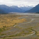
Right after departure, you’ll fly across the braided Waimakariri River. From the air, braided rivers are one of those rare natural features that look almost engineered—multiple channels weaving around gravel bars and splitting into patterns.
What’s fun here is how quickly your brain starts reading the scenery. You notice the difference between flat farmland in the foreground and the heavier, more chaotic river pattern below. It’s also a nice visual warm-up before you head toward the mountains, because the river gives you scale and texture.
A practical tip: keep your camera ready right as you approach the river. Braided systems can be brief from the helicopter viewpoint, and once you’re through, you’re onto the next landmark.
Castle Hill’s rockscape: the kind of scenery you understand best from above
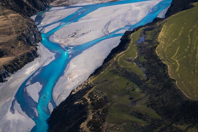
Next up is Castle Hill, famous for its striking rock landscape. From a driving viewpoint, you can see big rocks. From the air, you can see the layout—how the rock formations cluster, how the valley shapes frame them, and where the open spaces sit between features.
This stop works for two reasons:
- Castle Hill is visual even without explanation; you’ll instantly recognize that it’s something special.
- From the helicopter altitude, you get context for why it looks the way it does. The geometry becomes clearer.
If you’re the type who likes photographing landforms, you’ll likely enjoy the way your framing changes from channel patterns (Waimakariri) to rock formations (Castle Hill). You’re not repeating the same kind of shot. It’s variety, but all tied to the Canterbury alpine setting.
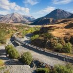
The Canterbury Plains to Chest Peak: you’re flying toward a 6,500 ft viewpoint
Then the flight shifts into “moving into the mountains.” You’ll head inbound for Chest Peak after flying over the Canterbury Plains.
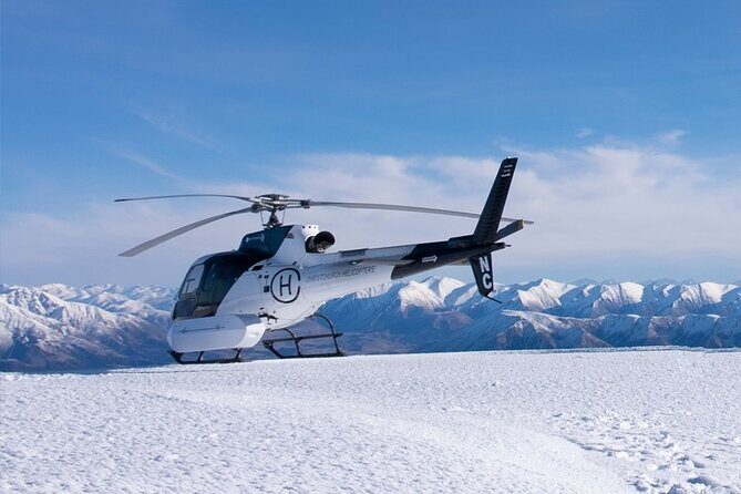
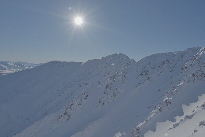
Chest Peak sits just under 6,500 ft, and you don’t just see it—you land there. That landing is the main reason this tour is worth your attention. A flyover is nice, but landing turns it into an actual viewpoint experience, with time for photos and a chance to look around slowly.
Why that landing is such good value
Because helicopter time is expensive, the best way to get value is simple: spend as much time as possible at the place you really want. This tour does that by landing at the top, giving you a stretch of high-elevation viewing that you can’t recreate from a bus or car.
Also, landing affects your photos. From above, everything looks like a layout. From standing at the top, you can capture depth, foreground-to-background layers, and the feeling of being part of the scene rather than just passing over it.
Spotting Flock Hill: sheep country shows up fast from the sky
One of the highlights is the chance to spot the expansive sheep station of Flock Hill. This is one of those details that makes helicopter travel feel different from plane travel. You’re not just watching mountains; you’re also seeing how people use the land.
From the air, a sheep station reads like a pattern—fenced fields, access lines, and the way buildings sit relative to roads and terrain. It’s practical, and it helps connect the Southern Alps story to everyday life in Canterbury.
If you like grounding big scenery with human scale, this kind of sighting is a win.
Top-of-mountain time: 360° views that actually pay off
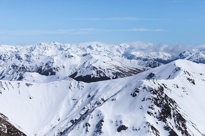
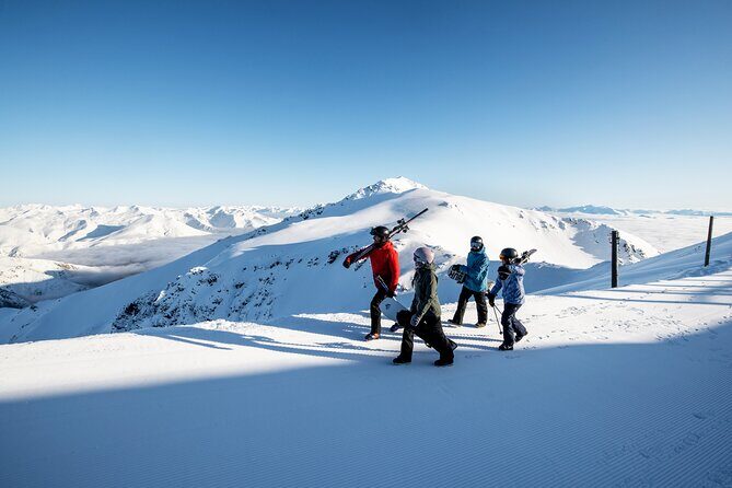
The headline moment is at Chest Peak: you get 360-degree views from the mountain top. This is the time window where you’ll rotate your camera and absorb the full region. Depending on light and cloud cover, you’ll see ridges stacking outward and the valleys folding down in different directions.
There’s something psychologically satisfying about being able to look around completely. It makes the region feel bigger than what you’d guess from a single perspective. It also gives you options for photos—wide shots for scale, closer shots for rock textures, and angles that show how the river and plains relate to the mountains.
And because your pilot is sharing explanations during the flight, you’re less likely to just snap pictures and then lose the thread. You can connect what you saw from above to what you’re looking at in front of you.
The pilot touch: Scott’s local stories add real meaning
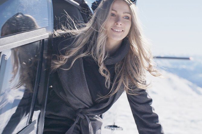
A big chunk of why people rate this so highly comes down to the human element. I noticed that the pilot’s role isn’t limited to navigation. Scott was professional, and he also explained sites and views in a way that made the scenery easier to name and understand.
This matters more than it sounds. Without guidance, aerial sights can turn into “cool, cool, cool” with no anchors. With a pilot who points out landmarks and adds local stories, you leave with a mental map that sticks.
If you’re the type who likes getting context, keep your attention on the pilot’s explanations. The best photos in a helicopter are often the ones where you know what you’re photographing.
Price and value: what you’re really paying for
At $1,284.59 per person, this is not a budget activity. So the question isn’t just whether it costs a lot. It’s whether the experience gives you the things that money buys well.
Here’s where the value shows up:
- You’re paying for short-time access to multiple major landmarks from the air.
- You’re paying for an actual landing at Chest Peak, which most helicopter sightseeing rides skip.
- You’re paying for a private group setup, which helps with pacing and attention.
- You’re paying for guided interpretation while you fly.
The drawback is also tied to price: for many people, a helicopter ride feels “brief” on paper. Your upside is that the time isn’t wasted. The flight includes viewpoints you can’t replicate easily by road and ends with meaningful top time.
If you’re deciding between a helicopter ride and a full day on the ground, this one leans toward a specific kind of traveler: you want your best views fast, with minimal effort and maximum scenery per hour.
Weather and expectations: two things that can change your experience
This experience requires good weather. That’s standard for safe flying, but it’s worth building into your planning. If you’re in Christchurch for only a tight window, consider keeping one extra day available for rescheduling.
The other expectation issue is very real. One review concern called out that the marketing didn’t line up with glacier expectations. The response clarified that if you want a glacier or snow experience, there’s a different flight option called Rakaia Glaciers.
So here’s my practical advice: before you book, make sure your chosen helicopter ride matches the scenery you’re chasing. If your goal is glacier shots, don’t rely on general Southern Alps hype. Pick the specific glacier flight.
Should you book Southern Alps Scenic?
I’d book this if you want a high-impact, short-duration way to see Canterbury’s alpine highlights from the air—especially if the idea of landing at Chest Peak and getting 360-degree mountain views excites you. The combination of guided storytelling, landmark spotting, and a true top-of-mountain stop is the kind of value that justifies the price.
I’d think twice if you’re expecting glacier scenery or snow. In that case, you’ll be happier choosing the glacier-specific option instead of hoping conditions or routing will match what you imagined.
If you like your travel photos to have context, and you want to feel the scale of the Southern Alps quickly, this is one of the better ways to do it.
FAQ
What is the total duration of Southern Alps Scenic?
The experience is listed at approximately 1 hour 15 minutes total, with flight time of about 1 hour 12 minutes.
Where do I meet for the flight?
You meet at Christchurch Helicopters, 25 Aviation Drive, Harewood, Aviation Park, Christchurch Airport, Christchurch 7676, New Zealand. The tour ends back at the same meeting point.
Is this a private tour?
Yes. It is described as a private tour/activity, with only your group participating.
Does the tour depend on weather?
Yes. The experience requires good weather. If it’s canceled due to poor weather, you’ll be offered a different date or a full refund.
What can I see on the route?
You’ll fly across the braided Waimakariri River, see Castle Hill’s rock scenery, fly over the Canterbury Plains inbound for Chest Peak, and you can spot the Flock Hill sheep station. You also land on Chest Peak for 360-degree views.
Is there a glacier included?
This specific ride is described as landing on Chest Peak in the Southern Alps and highlighting those regional views. If you want glacier scenery, there is a separate flight called Rakaia Glaciers.