REVIEW · AUCKLAND
Auckland: Auckland City & Hauraki Gulf Scenic Flight
Book on GetYourGuide →Operated by Waiheke Wings · Bookable on GetYourGuide
A sky tour over two worlds. This 45-minute scenic flight takes you from Waiheke Island up into the Hauraki Gulf and over to Auckland’s famous skyline, with a local guide calling out what you’re seeing as you go. It’s a fast way to get aerial context for a place that can otherwise take hours to piece together on the ground.
I especially love the way the flight makes Waiheke’s coastline feel tangible—beaches, shoreline bends, and vineyard patterns you just can’t fully appreciate from street level. I also like the Auckland segment, where you get dedicated photo time around the Sky Tower, plus big-city landmarks like the Harbour Bridge and North Head. The one thing to watch: this is weather-dependent, so your departure can shift if conditions aren’t right.
In This Review
- Key Points to Know Before You Go
- Why This 45-Minute Flight Feels Like the Best Deal in Auckland
- Price and What $178 Covers (and What It Doesn’t)
- Where You’ll Start (and Why the Meeting Point Can Vary)
- Takeoff Over Waiheke: Vines, Coastline Curves, and Beach Shapes
- Motuhie and Browns Islands: Hauraki Gulf Views with Real Depth
- Auckland Skyline, Sky Tower Half-Orbit, and Harbour Bridge Moments
- Rangitoto Volcano Crater: The Close-Up Highlight at 500 Feet
- How the Guide Commentary Makes the Views Stick
- What the Flight Feels Like in the Air (and How to Stay Comfortable)
- Packing Rules: What You Can Bring and What You Can’t
- Weather Matters More Than You Think
- Who Should Book This Scenic Flight (and Who Might Skip It)
- Should You Book Auckland City & Hauraki Gulf Scenic Flight?
- FAQ
- How long is the Auckland City & Hauraki Gulf Scenic Flight?
- How much does the flight cost?
- Where does the flight take off from?
- Do I get a guide during the flight?
- What sights will I see from the air?
- Is there time for photos of Sky Tower?
- What’s not included in the price?
- What do I need to bring?
- Are there baggage or equipment restrictions?
- Is the flight affected by weather?
Key Points to Know Before You Go
- 45 minutes, small group of up to 9: enough time for real sightseeing without dragging the day out
- Waiheke takeoff from among the vineyards: you start with coast-and-garden views from the moment you leave the ground
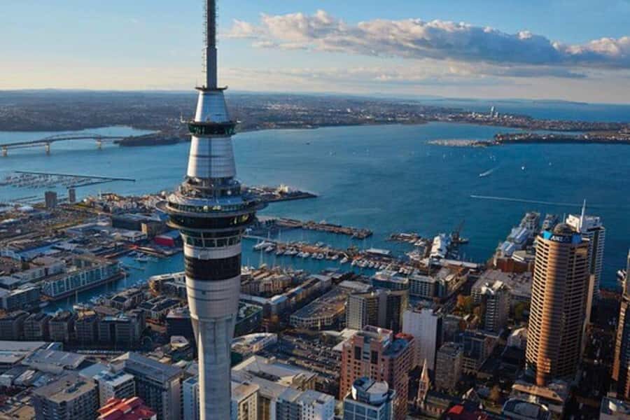
- Auckland skyline photo moment: including a half-orbit around Sky Tower
- Rangitoto crater view at about 500 feet (152 meters): a close, visual highlight of the flight
- English commentary + audio guide: you’re not just looking; you’re learning what you’re passing
Why This 45-Minute Flight Feels Like the Best Deal in Auckland
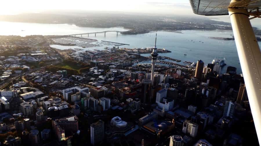
Auckland can be a “big city plus islands” kind of destination, but the logistics can be slow. This flight cuts through that. In under an hour, you get the natural drama of the Hauraki Gulf and the built skyline of Auckland in the same loop.
What makes it especially good value is that it’s not just a sightseeing loop with no context. You get local guide commentary, and there’s an English audio guide included too. That matters. From the air, a coastline can look pretty, but you’ll appreciate it more when you know what each stretch is and why it’s there.
I also like the pacing. You’re not rushed, but you also don’t sit around. The route gives you clear “chapters” of scenery—Waiheke first, then islands in the gulf, then Auckland’s downtown landmarks, then the volcanic focus with Rangitoto, and finally back to land.
One more practical note: feedback centers on how smooth the ride feels even in a small aircraft. If you’re a little nervous about flying, that’s a reassuring theme to keep in mind.
You can also read our reviews of more city tours in Auckland
Price and What $178 Covers (and What It Doesn’t)
At $178 per person for a 45-minute flight, you’re paying for two main things: aircraft time and guided interpretation. You also get the time-saving factor. If you’re short on days or you hate losing half your day to ferry schedules and transit, this can cost less than you’d spend “trying” to recreate the same views with ground transport.
What’s not included is food and drinks. That’s not a problem if you plan snacks around it, but it does mean you shouldn’t treat this like a half-day tour that takes care of meals.
Also, since it’s a scenic flight, you’re buying convenience and sky-level perspective. You won’t get a walking tour, and you won’t be stopping for long photo breaks on the ground. The payoff is the view itself—especially the dedicated skyline moment and the crater look.
Where You’ll Start (and Why the Meeting Point Can Vary)
The meeting point can vary depending on your option. The information you’re given at booking will determine where you check in. Starting options listed include North Shore Airport, and the flight itself is described as taking off from Waiheke Airport.
Plan for this as a “go where they tell you” activity. Arrive early for check-in. You’ll want at least 10 minutes before departure to get the safety briefing and settle in. Flights like this are small-group operations, so punctuality matters more than it does with big, public buses.
For your ID, bring your passport or ID card. You’ll also want comfortable clothes and shoes. From what’s stated, the plane’s temperature is similar to outside, so dress like you’re outside, not like you’re in an indoor terminal.
Takeoff Over Waiheke: Vines, Coastline Curves, and Beach Shapes
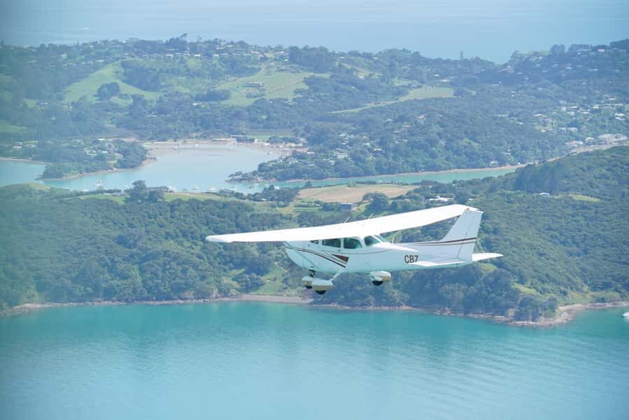
The most immediate payoff is the takeoff. You leave Waiheke Airport, and it starts among vineyards, which gives you a strong sense of scale right away. Then the coastline opens up, and you’ll see shoreline details that are hard to spot from a car—where bays widen, where beaches tuck in, and how the land meets the water.
If you like landscape photography, this is your “warm-up” segment. Early in the flight, you’re still acclimating to the angle from the cabin. Use it to get your eye in: watch for strong lines (coast edges), bright contrast (sand vs. rock), and repeated patterns (vineyard blocks).
One good way to enjoy it without stressing about the camera: pick a few “look categories.” For example:
- One pass for coastline shape and beaches
- One pass for vineyards and property boundaries
- One pass for water color changes and sheltered bays
That way you’ll feel like you’re seeing a set of meaningful scenes, not just a stream of images.
Motuhie and Browns Islands: Hauraki Gulf Views with Real Depth
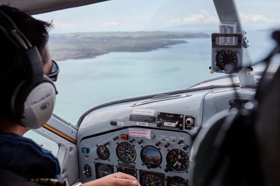
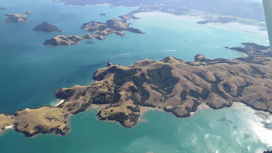
After leaving Waiheke’s immediate coast, the flight tracks toward Auckland and passes over islands in the Hauraki Gulf—specifically Motuhie and Browns Islands.
These are the kinds of islands that read as “dots” on a map. From the air, they become shaped objects with coastlines, inlets, and distinct relationships to the water around them. This part of the route adds depth between “island blur” and “city skyline.” It’s the transition zone where the gulf feels like a system, not just a collection of spots.
If you’re the type who likes geography, this section is great. You start to understand how close the islands are to the city and why people bounce between them for day trips. The flight makes those distances feel real.




Auckland Skyline, Sky Tower Half-Orbit, and Harbour Bridge Moments
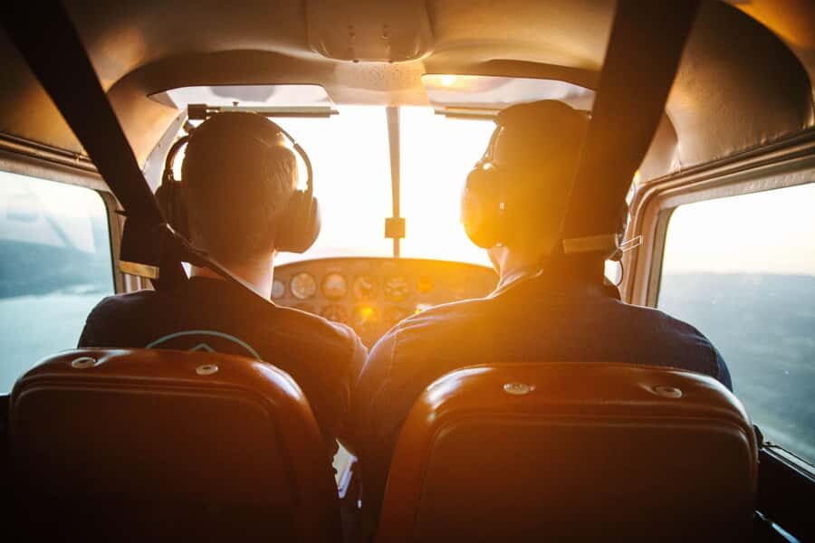
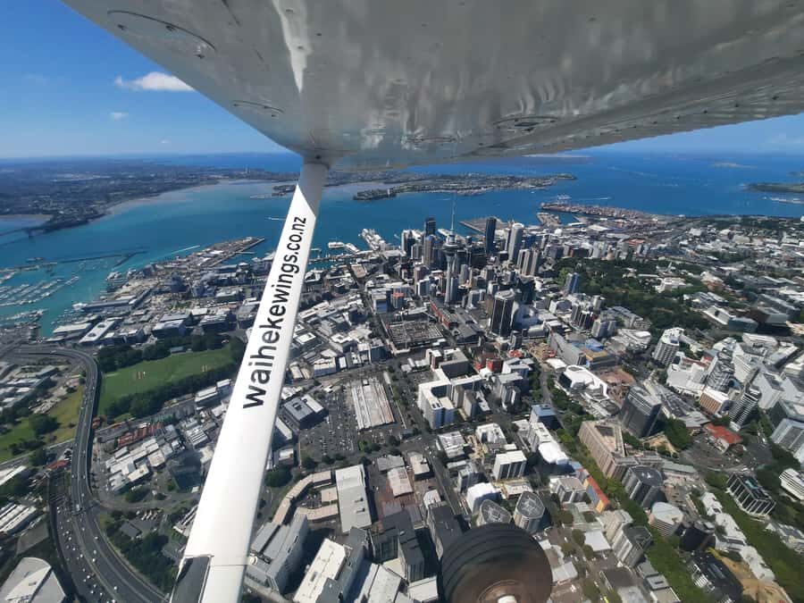
Then the route turns urban. You cruise past downtown Auckland, and there’s a special photography-focused moment: a half-orbit of Sky Tower. That’s a huge deal for a quick flight. It gives you more than a quick “flash by.” You get a chance to steady your framing as the tower rotates through your view.
As you continue, you’ll also fly past:
- the Harbour Bridge
- Davenport Naval Base
- North Head Volcano
This set of landmarks helps you connect Auckland’s identity—modern skyline, transport and maritime presence, and volcanic geography all in one pass.
A practical tip here: if you’re traveling with someone, decide ahead of time who’s responsible for photos vs. who’s responsible for scanning landmarks. In small aircraft, everyone tends to look at the same time. That can lead to missed moments. A quick plan keeps the experience smooth.
Rangitoto Volcano Crater: The Close-Up Highlight at 500 Feet
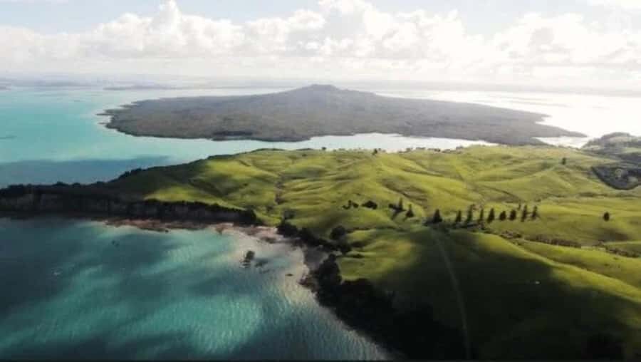
The volcano segment is the big “wow” focus. You’ll marvel at Rangitoto, noted as New Zealand’s youngest volcano, and you’ll peer into its crater while flying about 500 feet (152 meters) above the summit.
This is where the flight stops being “nice views” and becomes genuinely educational. From up high, you can see the volcano’s structure and the way it sits in the surrounding water and land. Then the crater look adds that extra layer—geology you can’t fake with a postcard.
Why this matters for your decision: Auckland is full of viewpoints, but crater access by air is rare. Even if you love photography, the real value is that you’re getting a perspective on the landform itself, not just a scenic overlook.
If conditions are good and light hits right, you might even catch atmospheric extras. One set of feedback mentions an arc of color during the experience—so if clouds and sun line up on your day, you could get an extra moment that feels like it’s just for your flight.
How the Guide Commentary Makes the Views Stick
A scenic flight can be either “pretty and forgettable” or “pretty and memorable.” The difference here is the human layer.
You get commentary from a local guide, plus an English audio guide is included. That combination helps you track what you’re seeing even if you’re not a geology nerd. The guide’s job is to turn a view into a story: what you’re passing, what the landmarks connect to, and why the Hauraki Gulf looks the way it does from above.
I also find commentary helps you enjoy the flight without constantly checking where everyone else is looking. If you know that the next highlight is Sky Tower or Rangitoto crater, your brain stops trying to guess and starts absorbing.
And since it’s a small group (limited to 9 participants), the flow feels more personal. You’re not stuck in a crowded herd where questions go unanswered.
What the Flight Feels Like in the Air (and How to Stay Comfortable)
This is 45 minutes in a small plane, which means comfort and expectations matter.
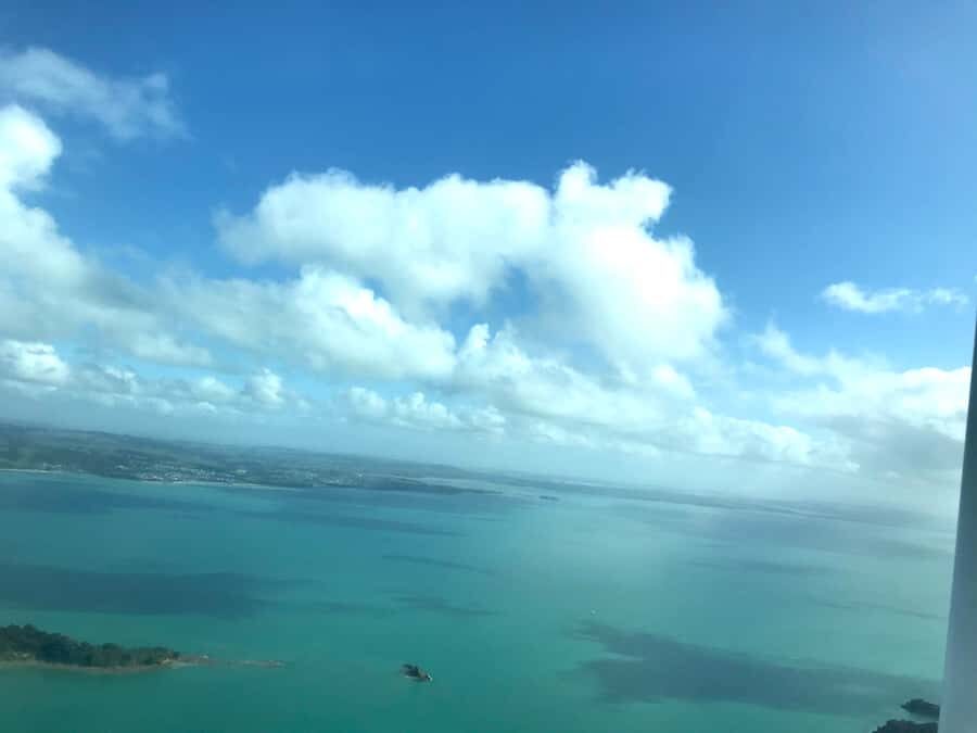
Based on what’s been shared in feedback, the ride is smooth. That’s important if you’re worried about motion. But you should still treat it like flying: strap in when asked, keep movement to a minimum, and dress for outdoor temperatures since the cabin follows outside weather more closely.
Also, you’ll be looking out through aircraft windows for the entire route. That’s great for photos, but it also means you’ll want to wear clothes that don’t make you uncomfortable for the full time. Think layers you can manage quickly.
Packing Rules: What You Can Bring and What You Can’t
A simple list, and you’ll be glad for it once you’re there.
What to bring:
- Passport or ID card
- Comfortable shoes and clothes
What’s not allowed:
- Luggage or large bags
- Selfie sticks
That last one is a common issue in tours with aircraft windows. Leave the stick at your accommodation and rely on regular phone handling or camera mounts you can safely manage.
If you’re used to bringing a full day bag, keep it light. You want your arrival to be stress-free, and your cabin experience to be comfortable too.
Weather Matters More Than You Think
This activity operates only if flying conditions allow safe and enjoyable experience. If weather cancels the flight, your booking can be rolled to the next available flying day.
That’s not a reason to panic—it’s just a reality check. Plan your Auckland stay with at least a bit of flexibility if you can. The recommendation is to book for your first available day so you have maximum options if you need to move.
If you’re the type who hates uncertainty, think of it like this: you’re paying for an aerial view, and aerial viewing is at the mercy of cloud cover, wind, and visibility. The best case is that conditions line up and you get clear, crisp skyline and crater detail.
Who Should Book This Scenic Flight (and Who Might Skip It)
This tour fits best if you:
- want both island scenery and city skyline in a short time
- love aerial viewpoints and want real “from above” context
- prefer small-group experiences with guide commentary
It’s not suitable if you exceed the weight limit listed: people over 243 lbs (110 kg). Also, since food and drinks aren’t included, don’t plan this as your meal plan.
If you’re traveling for a slow, deep immersion-style day with lots of walking stops, this might feel too quick. But if you’re trying to make your Auckland time count without sacrificing island time, it’s a smart choice.
Should You Book Auckland City & Hauraki Gulf Scenic Flight?
I’d book it if you want a high-impact Auckland experience that stays efficient. The combination of Waiheke takeoff, island-to-city progression, Sky Tower photo time, and Rangitoto crater viewing makes it feel like a complete “Auckland from above” sampler without turning your day into a schedule marathon.
You should also seriously consider it if you’re the kind of traveler who enjoys learning while sightseeing. With local guide commentary plus an English audio guide, you’re not just watching scenery pass—you’re getting the why behind it.
Skip it only if weather risk would ruin your plans. If you can give it a fair shot early in your trip and accept that conditions decide the timing, this flight is a strong use of time in Auckland.
FAQ
How long is the Auckland City & Hauraki Gulf Scenic Flight?
The flight duration is 45 minutes.
How much does the flight cost?
The price is $178 per person.
Where does the flight take off from?
It takes off from Waiheke Airport.
Do I get a guide during the flight?
Yes. You’ll have commentary from a local guide, and an English audio guide is included.
What sights will I see from the air?
You’ll see Waiheke’s coastline and vineyards, the Hauraki Gulf islands such as Motuhie and Browns Islands, Auckland landmarks including the Sky Tower, Harbour Bridge, Davenport Naval Base, North Head Volcano, and Rangitoto Volcano.
Is there time for photos of Sky Tower?
Yes. The route includes a half-orbit of Sky Tower for photos.
What’s not included in the price?
Food and drinks are not included.
What do I need to bring?
Bring your passport or ID card, wear comfortable shoes and clothes, and dress for outdoor-like temperatures.
Are there baggage or equipment restrictions?
Yes. Luggage or large bags aren’t allowed, and selfie sticks aren’t allowed.
Is the flight affected by weather?
Yes. The tour only operates if conditions allow safe and enjoyable flying, and if canceled due to weather, the booking can be rolled to the next available flying day.