REVIEW · GLENTANNER
Mount Cook: Mountains High 40 minute Flight
Book on GetYourGuide →Operated by The Helicopter Line Mount Cook · Bookable on GetYourGuide
You can’t see this kind of ice up close any other way. A Mount Cook helicopter flight gives you a fast, dramatic path to the Hochstetter Icefall and the upper Tasman Glacier, then tops it off with a landing in the snow when conditions allow.
I love that the flight is short but packed, so you get big National Park views without burning a full day. I also like the small-group setup and the pilot commentary, which helps you actually understand what you’re seeing above the ice and ridgelines. One thing to keep in mind: the most photogenic moment, the alpine landing, depends on snow levels and weather, so your experience can shift.
In This Review
- The 40-Minute Advantage Over Slow Scenic Options
- What You’ll Fly Past: Hochstetter Icefall and Upper Tasman Glacier
- The Snow Landing Photo Stop: The Moment You’re Planning For
- Flying Back Over the Burnett Mountains and Mackenzie Basin
- The Route Details That Matter: Where It Starts and How Timing Works
- Small Group Feel: Better Views, Less Noise, More Control
- What the Pilot Commentary Adds (and Why You’ll Care)
- Weather and Route Changes: Plan for Adaptability
- Practical Tips: What to Bring and What to Wear
- Who This Flight Fits Best (and Who It Might Not)
- Value for Money: How to Think About the $391 Price
- Key Points to Remember Before You Go
- Should You Book Mount Cook: Mountains High?
- FAQ
- How long is the helicopter flight?
- What will I see during the flight?
- Is there an alpine landing?
- Where does the flight start and end?
- Is it a small group?
- Can you provide transport from Mount Cook Village?
- Is the activity wheelchair accessible?
- What should I bring and wear?
- Are drones or selfie sticks allowed?
The 40-Minute Advantage Over Slow Scenic Options
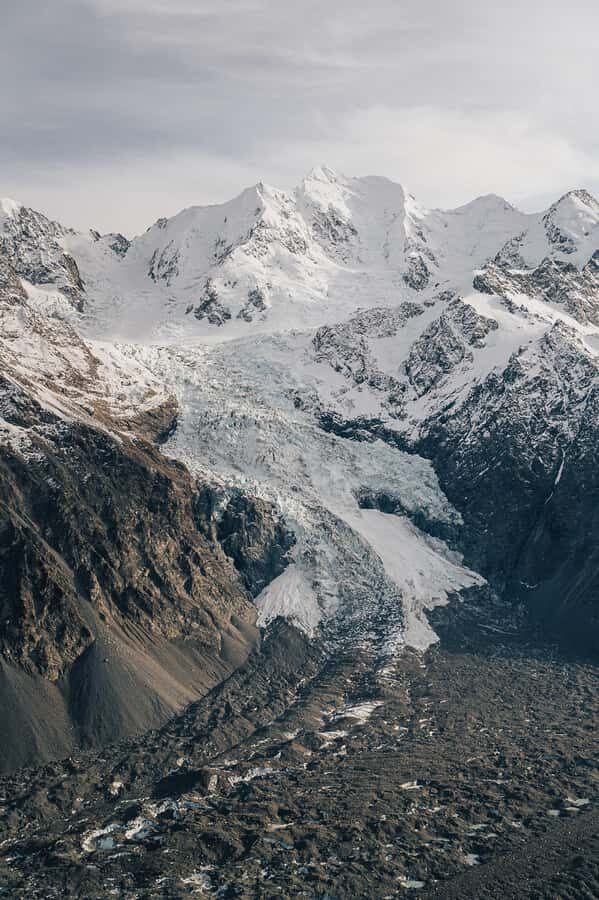
In Aoraki/Mt Cook National Park, scale can be hard to grasp from the ground. Roads give you wide views. Helicopters give you something better: height plus proximity. In about 40 minutes, you’re in the air long enough to follow the glacier lines, but not so long that you feel stuck on a single plan if weather is changing.
This is especially useful if you’re working around limited time in the South Island. If your Mount Cook days are already packed with hikes or scenic stops, this helicopter segment acts like a high-impact add-on. You get the glacial drama—icefalls, broken crevasses, and the long sweep of glacier tongues—without needing hours of travel and walking.
And because the group is capped at 6 participants, the atmosphere stays calm. It’s easier to hear the pilot, easier to compare what you’re seeing through your camera lens, and less chaotic than larger tour formats.
What You’ll Fly Past: Hochstetter Icefall and Upper Tasman Glacier
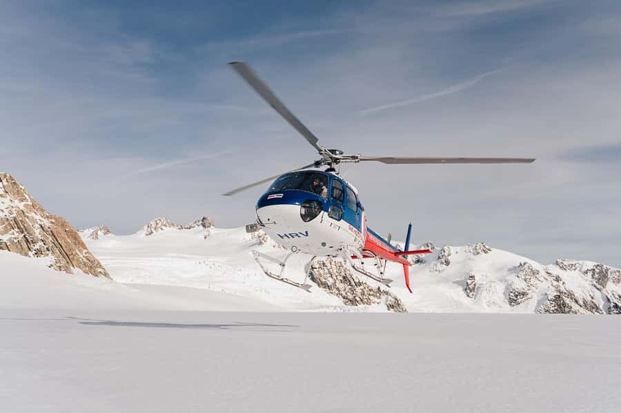
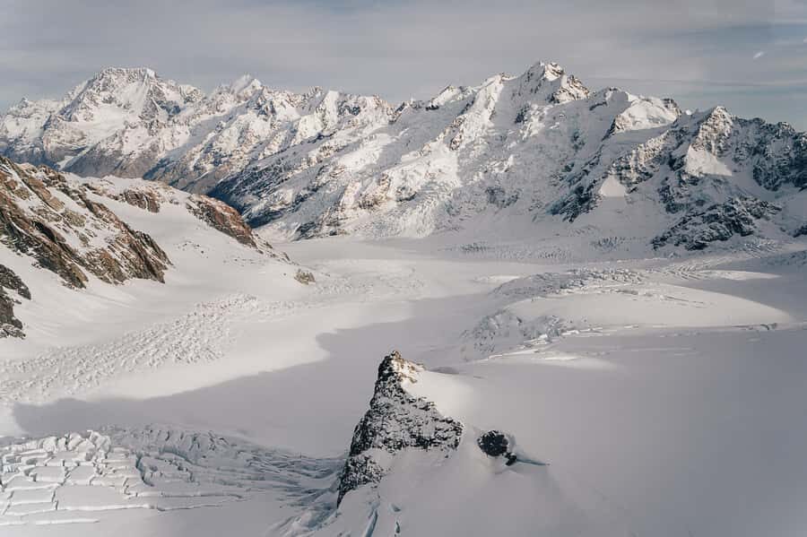
The star visuals start early. You’ll fly past the Hochstetter Icefall on Aoraki/Mount Cook, one of those places that makes you stop shooting photos for a second and just watch. Icefall looks like a frozen waterfall from above, but it’s moving in its own slow way—cracking and shifting as the glacier flows.
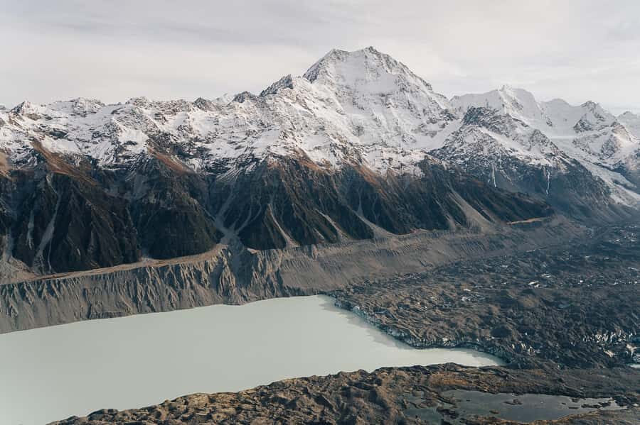
From there, the route continues toward the upper Tasman Glacier. From the air, you can see the glacier’s structure more clearly than you usually can from viewpoints on foot: the broad surface, the texture changes, and where the ice breaks into steeper sections. It’s the kind of aerial perspective that turns a glacier from a name on a map into a real physical system.
For me, this is the biggest reason to choose a helicopter here. You’re not just passing over mountains. You’re seeing the features that define Aoraki/Mt Cook National Park—ice and altitude—how they connect, and how they sit inside the wider mountain world.
You can also read our reviews of more tours and experiences in Glentanner.
The Snow Landing Photo Stop: The Moment You’re Planning For
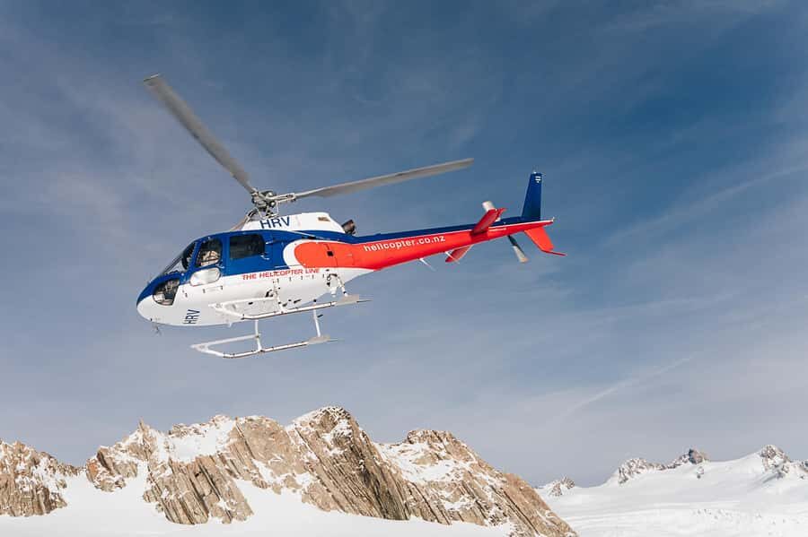
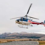
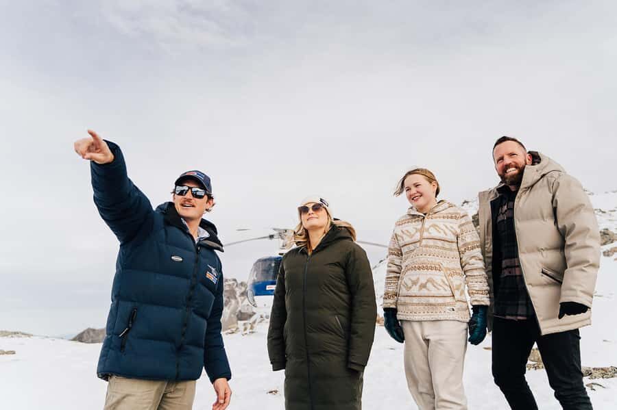
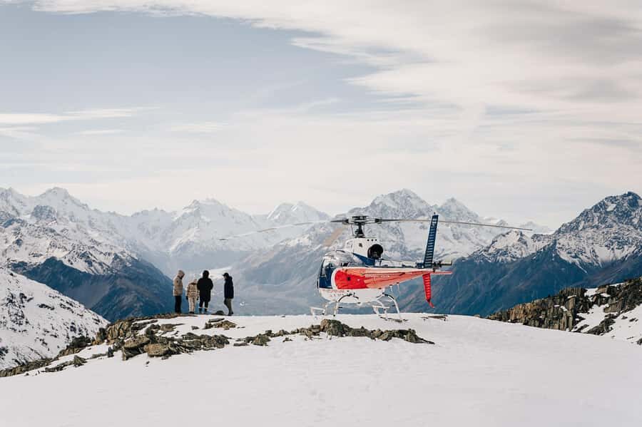
The flight includes an alpine landing in the snow, and that’s where the experience gets extra memorable. You’ll have time on the ground for epic photos and videos, plus that crisp, clean alpine air that makes the whole moment feel sharper and more real than a view from a bus window.
The big catch is that the landing is subject to snow levels. That means you should treat it as a best-case highlight, not a guaranteed outcome. If snow conditions are thinner or weather makes landing unsafe, the flight still gives you the aerial views, but the on-the-ground time may not happen the way you expect.
If you’re the type who really wants a sense of place—standing somewhere remote, not just looking at it—this landing option is a major value driver. It’s also the part of the experience that tends to feel most different from every other Mount Cook activity.
Flying Back Over the Burnett Mountains and Mackenzie Basin
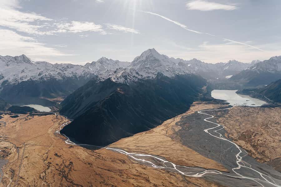
The return route is where you start to feel the region’s remoteness. After the main glacial highlights, you’ll fly back through the Burnett Mountains—the range facing toward Aoraki/Mt Cook—and look out across the Mackenzie Basin below.
The Mackenzie Basin is often described by its openness, and from the air you really see that dryness and wide spacing. It’s not just a backdrop. It gives you a sense of distance: how far the mountains are from settlements, and how large the protected area is compared with the human scale you’re used to.
This portion also helps you understand the geography. You start to connect what you saw earlier—icefall and glacier—with where it all drains and how the land opens outward. It’s a satisfying arc for a flight that lasts under an hour.
The Route Details That Matter: Where It Starts and How Timing Works
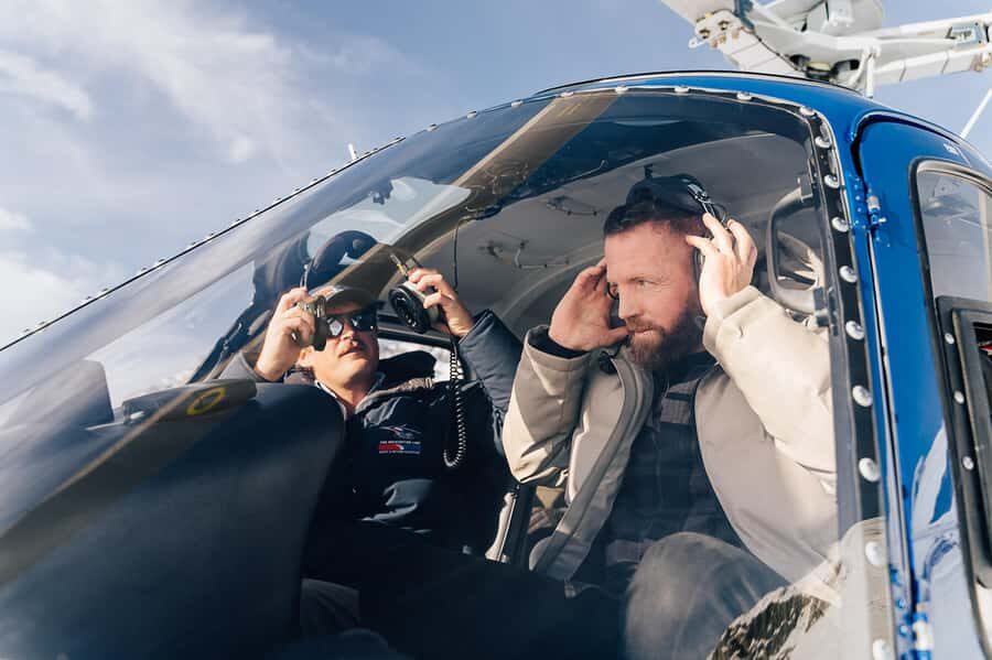
Your experience starts at The Helicopter Line, Mount Cook. The flight time is listed as 40 minutes, and that includes the landing time. That’s important because with short activities, timing can feel vague. Here, you’re not signing up for a long transfer plus a short airborne window. You’re paying for a compact, focused slice of airborne views.
There’s also the option of complimentary transportation to and from Aoraki/Mt Cook Village. If you’re not staying right near the helipad, this is a quality-of-life boost. You spend less time worrying about local logistics and more time thinking about what to capture on camera.
Small Group Feel: Better Views, Less Noise, More Control
A group of up to 6 participants changes the whole vibe. You’re not packed in with strangers asking constant questions through wind noise. It’s easier to keep track of what the pilot is describing, and you can move your camera at the right time without elbow-to-elbow stress.
It also tends to make the photo experience smoother. When you have a planned photo stop and a helicopter cabin that’s limited in space, you want things to feel orderly. Small groups help with that.
If you’re traveling with someone who wants the views but doesn’t want a chaotic tour environment, this size fits well. It’s also a good match if you like having the pilot commentary in a calm setting, not competing with a crowded loudspeaker effect.
What the Pilot Commentary Adds (and Why You’ll Care)
You’ll get informative pilot commentary in English. This matters more than people expect. When you’re flying over complex glacial terrain, a name like Tasman Glacier is just a label until someone explains what you’re looking at from above.
The commentary also helps you make sense of the route choices. Why you’re seeing a particular face of Aoraki/Mt Cook. Why the view shifts toward the Burnett Mountains and then opens out to the Mackenzie Basin. That turns the experience from sightseeing into something closer to understanding.
In a place like this, understanding is part of the value. You’ll get more satisfaction from your photos because they’ll connect to real geography.
Weather and Route Changes: Plan for Adaptability
The flight notes that routes and landings can vary due to weather and the pilot’s discretion, and flight times are approximate. This is normal for mountain flying, but it’s still worth taking seriously when you’re scheduling around other plans.
Here’s the practical approach: build some flexibility on your Mount Cook day. If you’re on a tight itinerary with no slack, pick a time slot that gives you buffer afterward. If weather affects the landing, you’ll still likely get the aerial highlights, but your exact highlight moment may shift.
You don’t need to panic about it, but you do need to respect that mountains run the show.
Practical Tips: What to Bring and What to Wear
Bring warm clothing. Even in fair seasons, alpine air can feel sharp fast, and you’ll want layers you can adjust quickly while you’re waiting and then once you’re settled in.
A camera is the obvious pick, but also plan for closed-toe safety with closed-toe shoes. You’ll be more comfortable if you can stand or shift without worrying about foot coverage.
And yes, there are clear no-go items: drones, selfie sticks, and tablets/iPads are not allowed on board. If you travel with any of those, leave them behind so you don’t lose time at check-in.
Who This Flight Fits Best (and Who It Might Not)
This is a strong choice if you want:
- Big Aoraki/Mt Cook and glacier views without a long day
- A rare chance to see the Hochstetter Icefall from above
- A shot at a memorable snow landing for photos
- A calm, small-group helicopter experience with pilot guidance
It may be less ideal if:
- You absolutely need the alpine landing to happen, no questions asked. Snow conditions can decide that.
- You’re very sensitive to changes in schedule. Weather can alter routes.
- Your main goal is a long hiking day. This flight is short on purpose.
For most people, though, it lands in the sweet spot: intense views, minimal time cost, and a trip that feels special even if you’ve already done a few walks around Mount Cook.
Value for Money: How to Think About the $391 Price
At $391 per person for 40 minutes, it’s not a budget activity. But value isn’t just price; it’s what you’re buying with that money.
You’re paying for:
- Access to terrain that’s hard to reach by foot or road in the time you have
- A guided aerial route over the exact glacial features that define the area
- An additional highlight if conditions allow: a snow landing
For travelers on a “see the highlights fast” strategy, this can be one of the best choices in Mount Cook, because it compresses the most dramatic geography into a compact window. If you’re already spending several days in the region, the helicopter flight can act like a visual reward for the effort you’ve put into the area.
Key Points to Remember Before You Go
- Hochstetter Icefall views from the air are the main draw and the reason this trip feels different.
- You’ll see the upper Tasman Glacier with a perspective most viewpoints can’t match.
- The flight includes a snow landing when snow levels allow, which is the best photo moment.
- The return route tracks the Burnett Mountains and opens out to the Mackenzie Basin.
- Small group (max 6) keeps the cabin quieter and makes pilot commentary easier to follow.
- Bring warm clothing and plan for restrictions: no drones, no selfie sticks, no iPads.
Should You Book Mount Cook: Mountains High?
I’d book it if you want maximum mountain drama in minimal time, and if you’re excited by glaciers you can actually see up close. The combination of the Hochstetter Icefall, the upper Tasman Glacier, and the potential for a remote snow landing makes this feel like a once-in-a-place moment, not a generic scenic flight.
I’d think twice only if your schedule is razor tight or if the landing is the whole point for you. Weather and snow levels can change that part of the plan.
If you can build a bit of flexibility into your Mount Cook day and you’re comfortable with the price for a short, high-impact experience, this helicopter flight is a very strong way to spend your time in the Southern Alps.
FAQ
How long is the helicopter flight?
The flight duration is 40 minutes, and the time includes your landing.
What will I see during the flight?
You’ll fly past the Hochstetter Icefall on Aoraki/Mount Cook and the upper Tasman Glacier, with views also over the Burnett Mountains and the Mackenzie Basin.
Is there an alpine landing?
Yes, the experience includes an alpine landing in the snow, but it is subject to snow levels.
Where does the flight start and end?
It starts and ends at The Helicopter Line, Mount Cook.
Is it a small group?
Yes. The group is limited to 6 participants.
Can you provide transport from Mount Cook Village?
Complimentary transportation can be provided to and from Aoraki/Mt Cook Village.
Is the activity wheelchair accessible?
Yes, it is listed as wheelchair accessible.
What should I bring and wear?
Bring warm clothing, a camera, and closed-toe shoes.
Are drones or selfie sticks allowed?
No. Drones, selfie sticks, and tablets/iPads are not allowed on board.