REVIEW · WANAKA
Wānaka: Scenic Helicopter Flight Wānaka Max
Book on GetYourGuide →Operated by Wanaka Helicopters · Bookable on GetYourGuide
Helicopter views, then a touchdown. The Wānaka Max is a 45-minute scenic flight that goes beyond looking from the sky by adding two alpine landings and a tight circuit packed with big-name natural sights. If you like moments that feel special (not just scenic), this one is built for that.
I like the way you get iconic viewpoints with actual “step outside” time at altitude, especially the Coromandel Peak – Mt Roy landing when conditions allow. I also love the route’s variety: the Matukituki River valley, Mou Waho’s famous lake-within-a-lake look, and the dramatic peaks around Mt Aspiring National Park.
One consideration: weather can affect the flight timing, and Coromandel Peak (Mt Roy) is listed as available rather than guaranteed. If clouds roll in, you may get a different outcome than the exact highlight sequence you’re hoping for.
In This Review
- Quick Hits Before You Fly
- Wānaka Max: What the 45 Minutes Really Delivers
- Getting Oriented at Wanaka Helicopters Office
- Two Alpine Landings: The Part Most Worth Paying For
- Coromandel Peak – Mt Roy: The Touchdown at 4,000 Feet
- Matukituki River Valley: The Aerial Corridor That Makes Sense
- Mou Waho Island: The Lake-in-a-Lake Detail
- Mt Aspiring National Park: Snow-Capped Peaks and Glacier-Carved Valleys
- Lake Hāwea, Stevensons Arm, and the Return Sweep Over Town
- Price and Value: Is $298 Worth It?
- What the Pilot and Small-Group Style Means for Your Experience
- Who Should Book Wānaka Max (and Who Might Skip It)
- FAQ
- How long is the Wānaka Max helicopter flight?
- Where do I meet for the flight?
- What do you actually do during the flight?
- Is the Coromandel Peak – Mt Roy landing guaranteed?
- Are meals and drinks included?
- Is there a live guide, and what language is it?
- Is smoking allowed?
- Is the experience wheelchair accessible?
- Should You Book It?
Quick Hits Before You Fly
- Two alpine landings turn a scenic loop into a hands-on experience
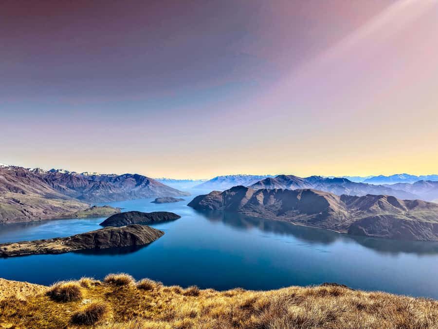
- Coromandel Peak – Mt Roy touchdown at about 4,000 feet for panoramic views
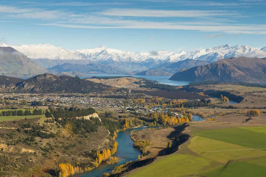
- Matukituki River valley views with peaks and native bush below
- Mou Waho Island gives the rare “lake within a lake” perspective
- Mt Aspiring National Park views tied to glacier-carved valleys and snow-capped drama
- Lake Hāwea and Stevensons Arm from above, plus a return sweep over Wānaka township
Wānaka Max: What the 45 Minutes Really Delivers
At $298 per person for 45 minutes, this isn’t the kind of activity you do “casually.” It’s more like buying a short window into places that normally take a lot of effort to reach. The value here comes from the mix: you get big aerial mileage, and then the trip adds two alpine landings, which is what turns helicopter sightseeing into something you’ll remember.
Also, you’re not just flying from point A to point B. You’re guided by an English live tour guide, and the route is designed as a loop—river valley, island feature, national-park peaks, then the return sweep over town. That matters because it reduces the time you spend staring at the same type of view.
Finally, the reviews lean hard on the pilot experience and the quality of the flight. One booking I saw mentioned pilot Travis by name, with the flight described as excellent from check-in through the airtime and landings. Another highlighted how the alpine landings on mountain tops were the clear highlight—so yes, you’re paying for the touchdown moments.
A few more Wanaka tours and experiences worth a look
Getting Oriented at Wanaka Helicopters Office
Your meeting point is the Wanaka Helicopters Office. The trip includes skipping the ticket line, so you’re not standing around waiting before the real fun starts. That sounds minor until you’re pairing this with a busy Wanaka day—45 minutes is short, and smooth timing helps you protect the rest of your schedule.
The flight is listed as wheelchair accessible, and that’s a big deal for helicopters because access can vary wildly by operator. If you’re planning this with mobility needs, it’s worth double-checking what the day-of flow looks like for your specific situation, but the activity is explicitly marked as accessible.
The one small rule that’s clear: no smoking. That’s standard for aviation, but it’s still good to know you won’t have to guess.
Two Alpine Landings: The Part Most Worth Paying For
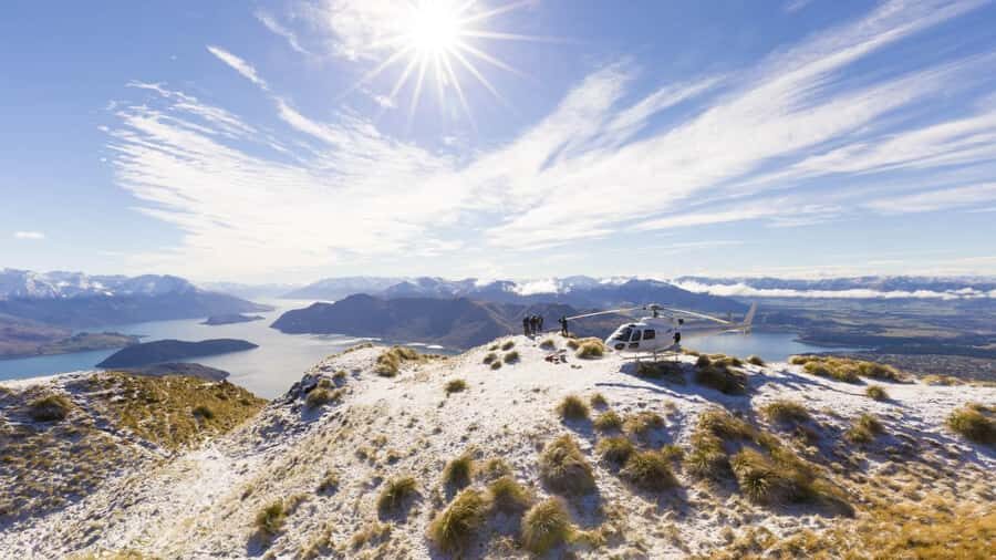
Most scenic flights sell you views. Wānaka Max sells you views and time on mountain-level terrain. You’re promised two stunning alpine landings, which means you’re not just hovering over geography—you’re touching down.
Here’s what that changes for you:
- You get a stronger sense of scale. From the ground, peaks and valleys feel closer and more real.
- You get photo time with less motion blur than pure aerial shooting.
- You get that rare travel feeling of being briefly “in the place,” not just above it.
The tradeoff is also real: mountain landings depend on conditions. The Coromandel Peak – Mt Roy landing is listed as if available, and that’s the practical reality you should plan around.
Coromandel Peak – Mt Roy: The Touchdown at 4,000 Feet
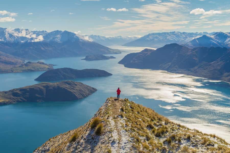
The headline moment is the landing at Coromandel Peak – Mt Roy when it’s available. You’ll touch down at around 4,000 feet, then take in panoramic views of the Lake Wānaka area and the township, with scenery spreading out beyond.
This is one of those viewpoints where being high matters. From the air, Lake Wānaka already looks big; from a mountain landing, it reads like part of a whole system—water, town, and the surrounding ranges in one frame. If you’re the type of traveler who likes to understand where things fit geographically, this stop is especially satisfying.
Potential drawback: if the conditions don’t cooperate, you may not land at Mt Roy. The trip will still aim to deliver the wider route highlights, but the “touchdown you planned around” is the element most tied to weather and operational constraints.
Matukituki River Valley: The Aerial Corridor That Makes Sense
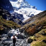
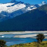
After takeoff, you’ll fly above the Matukituki River valley. The description emphasizes the river itself plus the way it’s bordered by towering peaks and native bush. This is a good stop if you like the “how the land works” view—rivers carve paths, and from above you can see how the valley funnels movement and shape.
Why I like this part of the route for you: it’s not just dramatic. It’s legible. You can often trace the river’s path and understand how it feeds into the broader waterways and basins nearby. That makes the flight feel coherent instead of random sightseeing.
Also, this valley segment pairs well with the timing. Since the whole flight is 45 minutes, you want the earlier portions to be strong, and the Matukituki stop is one of the route’s strongest early anchors.

Mou Waho Island: The Lake-in-a-Lake Detail
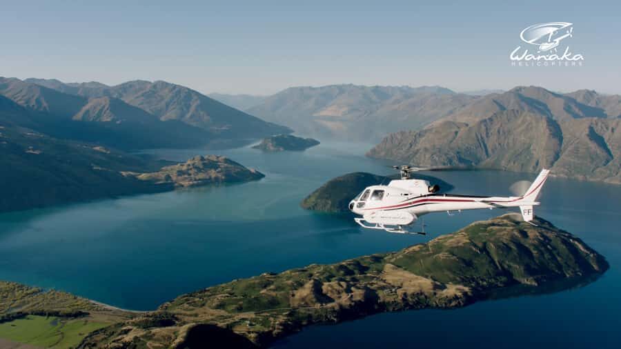
One of the most distinctive things on this flight is the view of Mou Waho Island, described as part of a protected nature reserve. The signature detail is the “lake within a lake” look, seen from above.
This is the kind of natural oddity that’s hard to appreciate from shore because you don’t get the straight-down angle that makes the feature pop. From the air, the shape reads instantly—one water surface nested inside another—so it’s a quick but memorable payoff.
The value here is simple: this isn’t just a scenic stop that looks pretty. It’s a visual concept you can’t really fake with other viewpoints. If you’re doing one helicopter experience in the region, this detail helps justify choosing this specific route.
Mt Aspiring National Park: Snow-Capped Peaks and Glacier-Carved Valleys
Then comes the part that most people picture when they think of the South Island: snow-capped peaks and large-scale mountain drama. You’ll get views tied to Mt Aspiring National Park, which is described as World Heritage-listed, and the route mentions glacier-carved valleys.
If you’re trying to decide between doing a flight in Wanaka versus spending more time on land, this is a core reason to consider it. You’re seeing glaciation-shaped terrain from a perspective that would otherwise take a serious day hike and still not give the same overall angle.
The practical catch: you’re watching this from a moving craft. If cloud cover limits visibility, you might not see the same crisp linework on the peaks. That’s why “weather might affect the exact flight” is something to accept rather than fight.
Lake Hāwea, Stevensons Arm, and the Return Sweep Over Town
The route closes out with contrasts: Lake Hāwea and Stevensons Arm from above. You get a guided look at the waterways and a circuit through the area, then you finish with a sweeping view of Wānaka township as you return to the airport.
I like this ending because it gives you context. Mid-flight, you’re busy absorbing mountains and river shapes. At the end, the town view helps you connect the geography back to where you’re staying. It’s one of the small ways this flight becomes more than “pretty pictures.”
Also, Stevensons Arm and Lake Hāwea are the kind of places that look different depending on the angle and light. From the air, you’ll often notice how the water edges, inlets, and surrounding ridges interact.
Price and Value: Is $298 Worth It?
Let’s be honest: $298 is not a budget helicopter splurge. The only way it makes sense is if you’re buying something specific—time on mountain terrain, plus a route that stacks multiple major features into one tight 45-minute outing.
Here’s the value math I’d use for you:
- If you’d otherwise spend hours driving or hiking to chase a few viewpoints, a single flight can compress that effort into one block of time.
- Two alpine landings are a meaningful differentiator. Many flights stay airborne the whole time.
- The route includes a “signature feature” (Mou Waho’s lake-within-a-lake) plus the Mt Roy landing when available, plus Mt Aspiring National Park views.
So yes, it’s expensive for a short duration, but this isn’t just a short duration. It’s a short duration packed with high-impact moments. If those moments are what you’re after, the price starts looking more reasonable.
If you’re purely price-sensitive or you hate the idea of weather-driven changes, you might feel uneasy. The trip can be postponed due to weather or pilot availability, and exact landing access can vary.
What the Pilot and Small-Group Style Means for Your Experience
One repeated theme in the feedback I saw: the pilot’s guidance makes the trip feel smooth and informative. People described a welcoming flow from reception to check-in, and they also praised pilots for pointing out special parts of the route.
One booking even called out a pilot named Travis for being both a strong guide and pilot. Another noted a small-group vibe with a great pilot and an enjoyable flight. Even if you don’t meet the same person, that pattern tells me the operator focuses on the human side, not just the helicopter.
Why this matters: in a 45-minute experience, you don’t have time to recover from confusion. A pilot who gives clear cues helps you look at the right thing at the right time—especially for mountain landings and the quicker features like Mou Waho.
Who Should Book Wānaka Max (and Who Might Skip It)
This experience fits best if you:
- Want maximum visual variety in a short time window
- Care about alpine landings rather than only flying overhead
- Like the “big-picture” view—river valleys, national-park peaks, lake systems
- Have a photography mindset and want moments that feel more dramatic than just pulling over for a lookout
You might skip it if you:
- Are hoping for one very specific landing and would be disappointed if Coromandel Peak – Mt Roy isn’t available
- Prefer low-cost sightseeing options, since the price is real
- Don’t enjoy the idea that weather can affect confirmation timing after booking
FAQ
How long is the Wānaka Max helicopter flight?
It lasts 45 minutes.
Where do I meet for the flight?
You meet at the Wanaka Helicopters Office.
What do you actually do during the flight?
You fly over the Wānaka region and take in views including the Matukituki River, Mou Waho Island, Mt Aspiring National Park, and Lake Hāwea/Stevensons Arm, plus you get two alpine landings.
Is the Coromandel Peak – Mt Roy landing guaranteed?
It’s listed as if available, so it may depend on conditions.
Are meals and drinks included?
No. Meals and drinks are not included.
Is there a live guide, and what language is it?
There’s a live tour guide in English.
Is smoking allowed?
No, smoking is not allowed.
Is the experience wheelchair accessible?
Yes, it is wheelchair accessible.
Should You Book It?
If you want a helicopter flight that feels more like a “go experience” than a “look from above” session, I’d book Wānaka Max. The combination of two alpine landings, the Coromandel Peak – Mt Roy touchdown when available, and the specific route highlights (Matukituki River valley, Mou Waho’s lake-within-a-lake, and Mt Aspiring National Park views) makes it strong value for what you’re paying.
Just go in with one smart mindset: accept that weather can change timing and landing availability. If you can handle that, this is the kind of Wanaka activity that delivers memories you can’t replace with a drive to a lookout.