REVIEW · AORAKI MOUNT COOK NATIONAL PARK TE WAHIPOUNAMU
55 minute Grand Circle Ski Plane
Book on Viator →Operated by Inflite Ski Planes Limited · Bookable on Viator
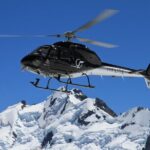
Flying above glaciers is oddly calm. This 55-minute ski plane ride through Mt Cook and Westland National Parks is built for big Southern Alps views, including time for two glacier snow landings when conditions allow. From take-off, you’re already staring at the main peaks and ice fields, not wasting time getting to the good stuff.
I love how much you actually see in a short window. The flight path runs right around Aoraki Mt Cook and then swings toward the Fox and Franz Josef glacier country, so your photos aren’t just “mountains in the distance”—they’re ice, ridges, and glacier systems up close.
The one catch to plan for is that this experience is weather-dependent. If conditions aren’t safe, flights can be canceled, and the glacier landing plan can change based on snow.
In This Review
- Key Highlights Worth Getting Excited About
- Price and What You’re Actually Paying For
- Flying the Southern Alps Loop: How the Route Works
- Take-Off at Mount Cook Airport: Views Start Immediately
- Around Aoraki Mt Cook: The Main Divide Feeling
- Fox and Franz Josef Area: What You’re Looking At
- Tasman Sea Stretch and Recrossing Back Toward the Ice
- The Glacier Landings: Snow/ice Time on the Ground
- Grand Plateau, Hochstetter Icefall, and Plateau Hut Area Views
- Descent Over Tasman Terminal Lake: The Final Big View
- What’s Included (and What Isn’t)
- Group Size, Ticket Format, and the Day-of Feel
- Weather: How It Can Change What You See
- Who This Ski Plane Tour Is For
- Should You Book This 55-Minute Ski Plane Flight?
- FAQ
- How long is the ski plane experience?
- Where does the tour start and end?
- What is the price per person?
- What’s included in the price?
- Are souvenir photos included?
- Is a mobile ticket used?
- What happens if there isn’t good snow for two landings?
- Will the flight run in any weather?
- What is the check-in deadline?
- Are there age requirements for children?
Key Highlights Worth Getting Excited About
- Two glacier snow landings (often; snow conditions decide)
- A flight path that loops key ice zones from Mt Cook to Westland
- Views over the Fox and Franz Josef glacier areas and toward the Tasman Glacier
- Grand Plateau and Hochstetter Icefall sightings during the mid-flight stretch
- Aircraft engines shut down on landing, giving you a real pause to take it in
- Hotel pickup and drop-off included, so you’re not stressed about timing
Price and What You’re Actually Paying For
At $482.92 per person, this isn’t a budget add-on. But the value isn’t just the price tag—it’s what you get packed into 1 hour 5 minutes: a guided flight route over the Southern Alps, plus glacier landing time that most people never get.
You’re also paying for access. A ski plane is designed for this kind of operation, and that matters when you’re trying to see and step onto snow/ice year-round. If you’re the sort of traveler who’s watched glacier videos for years and wants the real thing, this is one of the more direct ways to do it.
A couple of practical notes that affect value: hotel pickup/drop-off is included, but souvenir photos aren’t (you can buy them). So if you want a printed memory, budget for that separately.
A few more Aoraki Mount Cook National Park Te Wahipounamu tours and experiences worth a look
Flying the Southern Alps Loop: How the Route Works
This tour is paced like a scenic “grand circuit” flight: you spend most of the time in view of major peaks and ice systems, and you’re not stuck watching the same terrain for the whole hour.
You start at Mount Cook Airport, and the core idea is a loop that connects:
- the Aoraki Mt Cook area,
- the West Coast glacier country,
- and then back toward the Tasman and Mt Cook regions.
That route choice is the point. It means you’re not just “passing over glaciers.” You’re seeing how they sit in their broader mountain context—valleys, ridgelines, and the way the ice fields relate to the Southern Alps divide.
Take-Off at Mount Cook Airport: Views Start Immediately
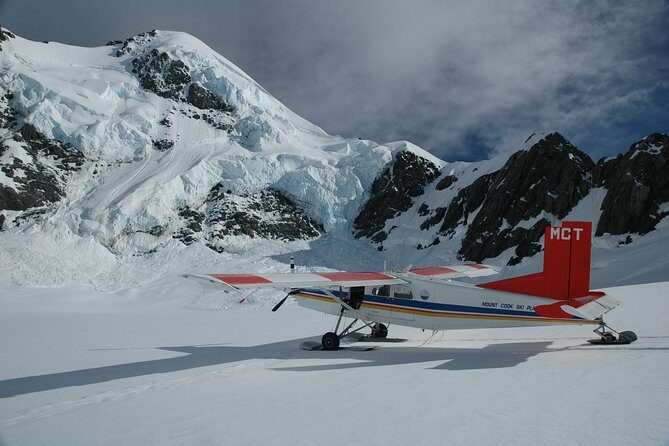
Check-in closes 45 minutes before your flight time, so I’d treat this like a real departure day, not a casual stop. Hotel pickup and drop-off help a lot here, because you’re not juggling your own transport on a schedule that’s dictated by flight conditions.
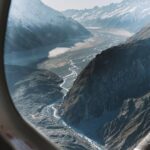
As soon as you get airborne, the views are a major part of the payoff. The flight is planned so you get great perspective right from take-off—no long “getting there” stretch.
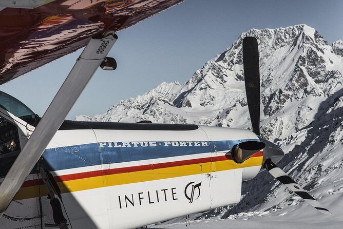
One review detail I found especially useful: some flights can put you higher than you might expect, and that can bring you surprisingly close to Aoraki Mt Cook. Even if you can’t control how close your aircraft ends up to the summit area, the overall route is clearly designed to give strong mountain angles.
Around Aoraki Mt Cook: The Main Divide Feeling
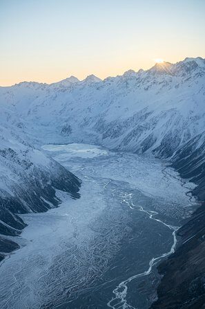
Once you’re heading toward the peaks, you’re basically flying the Main Divide concept—this is where the Southern Alps really read as a barrier and a spine, with snow-draped high country on one side and West Coast terrain on the other.
You’ll get views right around Aoraki Mt Cook, with the route designed to show you the scale of the massif instead of treating it like a single peak. It’s also the part of the flight where you tend to get that “mountains everywhere” feeling—because you’re up high enough to see the system, not just the nearest ridgeline.
If you’re someone who likes understanding geography visually, this section is a good match. You’re not just collecting pretty shots; you’re seeing how the Alps shape the region.
Fox and Franz Josef Area: What You’re Looking At
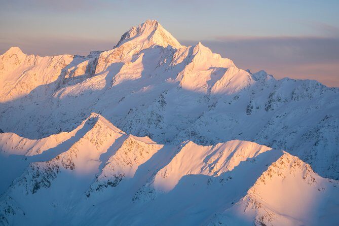
As the flight swings west, you’ll be seeing toward the glacier zones associated with the Fox and Franz Josef. This is one of the most distinctive parts of the route because it links the dramatic high peaks to the West Coast glacier world.
A small caution: glaciers can look like “big white blobs” from far away, especially on a plane. Here, the value is that the flight path is oriented to keep you looking at the glacier country long enough to get a sense of form—where ice gathers, how it sits in valleys, and how ridges frame it.
This is also a good moment for calm patience. If you’re trying to photograph, you’ll want to keep your eyes on the ice shapes first. Once you’re satisfied you’ve seen the geography, then you can focus on the “hero shot.”
Tasman Sea Stretch and Recrossing Back Toward the Ice
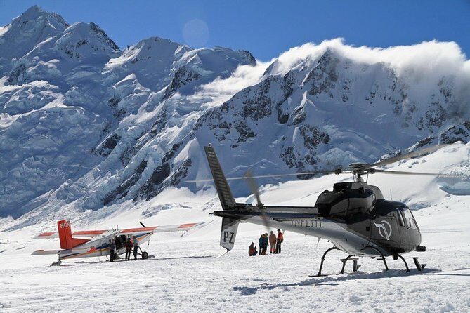
The itinerary includes tracking north along the Tasman Sea, then recrossing the snow-capped peaks of the Southern Alps to the Tasman Glacier area.
Why this matters: it gives you contrast. You see the way the sea and coastal world relate to the mountains, and then the flight turns back into deeper ice-country context. That recrossing is also where you’ll often appreciate how the Southern Alps run like a continuous system, not isolated photo stops.
If you’re prone to “I only want the glacier part,” this segment might still be worth your attention. It helps you understand what’s different about each side of the divide.
The Glacier Landings: Snow/ice Time on the Ground
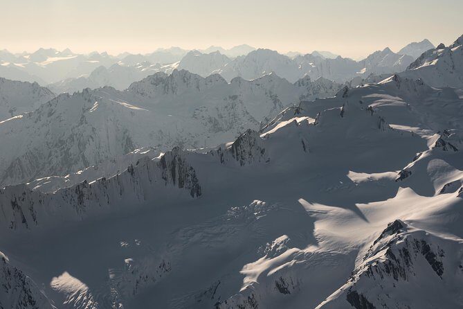
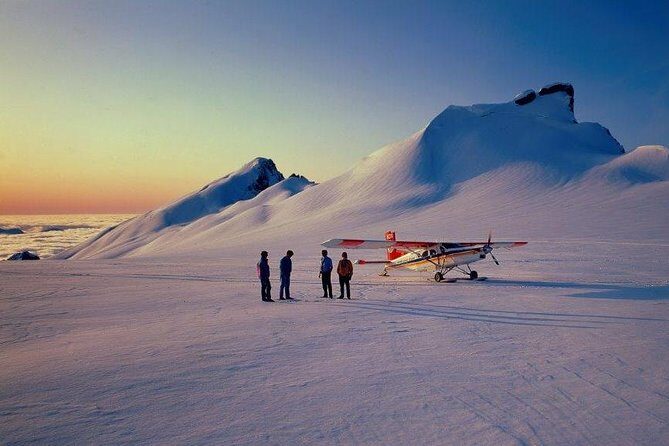
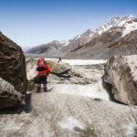
Here’s the heart of the experience: glacier snow landings. The tour description calls out two glacier snow landings, which can be substituted with one longer landing depending on snow conditions.
That substitution rule matters because it’s the operator working within reality: snow and ice change, and safety and landing feasibility come first. From a traveler’s perspective, the practical takeaway is simple: don’t assume you’ll automatically get exactly two equal stops. Go in expecting the landing plan to be shaped by conditions on the day.
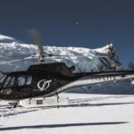
One particularly memorable detail is that the aircraft completely shuts down on landing. That change in sound and motion is more than a gimmick. It gives you a short window where the moment feels grounded—quiet, still, and focused—so you can take in your surroundings without the constant engine hum.
If you’re hoping for a once-in-a-lifetime photo, this is also where timing matters most. Pay attention to what the guide and pilot are doing, because landing windows aren’t long. Keep your camera ready, then relax into the experience.
Grand Plateau, Hochstetter Icefall, and Plateau Hut Area Views
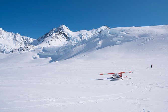
Mid-to-late flight includes passing over the Grand Plateau and the Hochstetter Icefall, plus views connected with the Plateau Hut area.
This is the kind of place where names add meaning. An icefall isn’t just “more ice.” It’s a complex, moving structure where the glacier breaks into chaotic blocks. Even without getting technical, the visual impact is real: ice textures, steepness, and motion-like patterns are easier to spot when you’re looking down into the right zones.
The Grand Plateau segment helps you see the broader platform before you reach the more dramatic ice features. It’s the “scale and setting” portion of the story, which makes the icefall views feel more special when they arrive.
Descent Over Tasman Terminal Lake: The Final Big View
As the flight tracks south down the Tasman, you’ll continue toward the Tasman Terminal Lake. This is the “closing act” view, and it’s one of those moments where you realize how connected everything is—from high ice fields down into the lower end of glacial systems.
Even if you’re tired after 55 minutes in a cold-air environment (yes, snow and ice are part of the deal here), this last stretch tends to be the one you want to look at twice. The earlier parts show you the spine and ice zones; the final stretch helps you see the glacier’s outcome—where it ends and how the region opens up.
What’s Included (and What Isn’t)
Included:
- Hotel pickup and drop-off
- Professional guide
Not included:
- Souvenir photos (available to purchase)
That inclusions list is refreshingly straightforward. Pickup/drop-off reduces stress, and having a professional guide improves the experience because you’re not just staring out a window hoping to guess what you’re seeing.
For costs, remember the photos are extra. If you care about a printed or professionally handled set, you’ll likely want to plan for that decision during or after the flight.
Group Size, Ticket Format, and the Day-of Feel
You’ll be in a small group—maximum 18 travelers. That’s a meaningful detail. Larger groups can make it harder to manage timing and questions. Here, the format supports a more organized, efficient experience.
You’ll also use a mobile ticket, which is handy if you prefer not to deal with paper vouchers.
The tour also notes it’s near public transportation, but since hotel pickup/drop-off is included, I’d treat that as a backup option rather than the plan.
Weather: How It Can Change What You See
This is a flying tour in a mountain environment, so weather isn’t a minor factor. Flights may be canceled due to weather conditions, and you’ll be offered a different date or a full refund.
Even when the flight runs, landing plans can change. Dual landings are subject to snow conditions, and might be swapped for one longer landing.
What I recommend: if your trip schedule is tight, consider building in flexibility. If you’re visiting during a period when weather can be unpredictable, it’s smart to treat this as a priority activity you’re willing to reschedule rather than something you’re locked to on a single day.
Who This Ski Plane Tour Is For
This is a great fit if:
- you want a glacier experience without the multi-day planning of ground hikes,
- you’re excited by aerial geography and want to connect Mt Cook to the West Coast glacier zones,
- you like short, focused activities with maximum scenery time.
It’s less ideal if:
- you dislike weather uncertainty (since flights can be canceled),
- you need strict timing certainty on a single day,
- you’re not interested in aerial views and glacier landing time.
Should You Book This 55-Minute Ski Plane Flight?
I’d book it if your goal is simple: see the Southern Alps and glaciers in one concentrated hit, with real snow/ice time on the ground and a guide steering the experience.
The price is steep, but you’re paying for access and for the “wow factor” of glacier landings—plus the route that strings together Mt Cook, Tasman areas, and West Coast glacier country within a tight 55-minute flight. Add hotel pickup/drop-off, small group size, and that engine shut-down moment on landing, and the experience feels built for travelers who want something different than yet another scenic drive.
If your schedule is flexible and you’re okay with weather-based changes, this is one of those trips where the odds of satisfaction are high.
FAQ
How long is the ski plane experience?
The flight duration is about 1 hour 5 minutes.
Where does the tour start and end?
It starts and ends at Mount Cook Airport (Mount Cook Road, Canterbury Region 7999, New Zealand).
What is the price per person?
The price is listed as $482.92 per person.
What’s included in the price?
Hotel pickup and drop-off are included, along with a professional guide.
Are souvenir photos included?
No. Souvenir photos are available to purchase.
Is a mobile ticket used?
Yes, the tour uses a mobile ticket.
What happens if there isn’t good snow for two landings?
Dual landings are subject to snow conditions and may be substituted to one longer landing.
Will the flight run in any weather?
It requires good weather. Flights may be canceled due to weather conditions, and you’ll be offered a different date or a full refund.
What is the check-in deadline?
Check-in closes 45 minutes prior to the flight time.
Are there age requirements for children?
Children must be accompanied by an adult.