REVIEW · KAIKOURA
Kaikoura: Coastal and Alpine Scenic Airplane Flight
Book on Viator →Operated by Air Kaikoura · Bookable on Viator
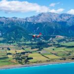
Skimming Kaikoura from the air feels unreal. This panoramic flight turns Seaward Kaikoura ranges and the Kaikoura Peninsula into a front-row view, with your pilot pointing out mountain, earthquake, and coastline details along the way. I love the mix of resident seals and big-sky turquoise ocean from above, and I also like the extra context the pilot shares so it feels more like a guided flight than window gazing. The main catch is simple: this experience depends on good weather, so if conditions are poor you may be offered a new date or a refund.
Because the group is capped at 7 people, the flight feels personal and you won’t be packed in. You’ll depart from 627 State Highway 1 in Peketā, do a short loop of coastal and alpine views, and return right back to the same meeting point—perfect when you want a high-impact experience without losing half a day.
In This Review
- Key Highlights You’ll Actually Care About
- 25 Minutes of Coastal and Alpine Views Over Kaikoura
- Climb Past Mount Fyffe: Alpine Flying Without the Long Drive
- Lake Hapuku and the 2016 Earthquake Footprint
- Black Sand Beach and the Hapuku River Mouth Approach
- Kaikoura Peninsula Seal Country From Above
- Pilot Commentary, Group Size, and the Feel of Air Kaikoura
- Price and Value: Why $108.60 Can Make Sense
- Weather Reality: What to Do With Cloudy Conditions
- Getting There in Peketā: Check-In and What Happens at the End
- Who Should Book This Scenic Flight (and Who Might Want a Plan B)
- Should You Book This Kaikoura Coastal and Alpine Flight?
- FAQ
- How long is the flight?
- What does the scenic flight cost?
- Where do I meet for the flight?
- What time should I arrive for check-in?
- How many people are in the group?
- Is good weather required?
- What if I’m over 120 kg?
- Do I get a ticket on my phone?
- Can I bring a service animal?
Key Highlights You’ll Actually Care About
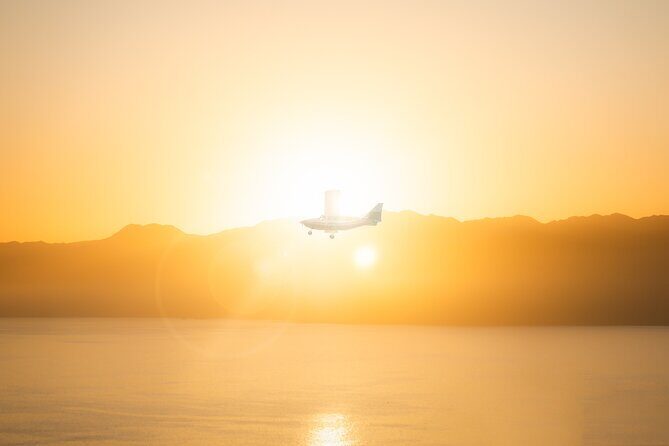
- 25 minutes, lots of variety: coast, mountains, earthquake effects, and seal country in one short hop.
- Climb to around 6,000 feet: a real change in perspective for the Seaward Kaikoura range.
- Mount Fyffe in the flight path: you’ll fly past it after take-off for genuine “mountain flying” views.
- Lake Hapuku formed after the 2016 earthquake: you see the coastline change up close from above.
- Black sand beach approach: an easy-to-recognize feature when the light is right.
- Resident seals near the peninsula: you may spot them along the turquoise-water edge if visibility cooperates.
25 Minutes of Coastal and Alpine Views Over Kaikoura
If you like your travel fixes fast and visual, this one works. You’re in the air for about 25 minutes, but the route is packed: the Seaward Kaikoura ranges, the Kaikoura Peninsula, and several “spot-this-from-above” moments in between. From the moment you lift off, the coast stops looking like a brochure and starts looking like a map—curves, bays, river mouths, and cliffs become easy to understand.
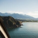
You’ll also get a genuine sense of scale. Kaikoura is famous for its mix of ocean and steep terrain, and from the sky that relationship clicks instantly. The turquoise water and dark beaches aren’t just pretty—they show you how the land drops away, where the peninsula narrows, and how close the mountains sit to the sea.
On a good day, it feels like you’re seeing multiple Kaikouras at once: alpine views, earthquake-caused changes inland, and the coastal edges where marine life hangs out. Even if it’s not perfectly clear, you can still come away with a strong “from-above geography” feeling.
You can also read our reviews of more tours and experiences in Kaikoura.
Climb Past Mount Fyffe: Alpine Flying Without the Long Drive
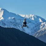
After take-off, you’ll climb to about 6,000 feet, and that’s where the trip starts feeling special. This isn’t just flat coast sightseeing; you’ll fly past the back of Mount Fyffe, which gives you that satisfying mountain-flying angle. At this height, the terrain turns into layers—ridges, valleys, and peaks stack up in a way you can’t replicate from the ground.
The operator describes the possibility of snowy mountain peaks during the flight, which depends on conditions and season. If the mountains are capped, it’s one of the cleanest ways to see how close Kaikoura’s coastal scenery is to alpine conditions.
Your pilot may also point out features you might only catch if you’re paying attention: there can be waterfalls visible from above, and even wild deer if your eyes are sharp enough. The practical takeaway: sit where you can look out consistently, keep your gaze moving, and don’t expect everything to be obvious instantly. From the air, small details reward patience.
Lake Hapuku and the 2016 Earthquake Footprint
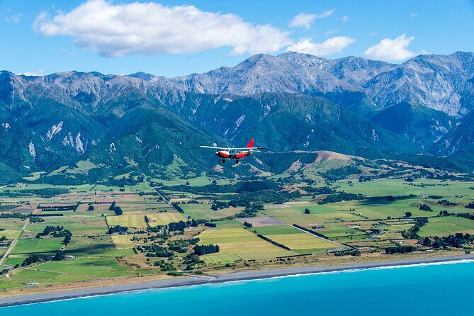
One of the most interesting parts of the route is Lake Hapuku. It’s described as a direct result of the 2016 Kaikoura earthquake, and that changes how you’ll see the coast. Instead of treating the water as just scenery, you’ll understand it as a landscape that was altered.
From above, these kinds of changes can look straightforward: altered shorelines, new water bodies, and different shapes around the coast. The flight gives you a quick “before-and-after” feeling without needing any textbooks. It’s not dramatic in a movie way—it’s more real than that—because the geography is what you’re actually riding over.
You’ll overfly Lake Hapuku and then your pilot will descend toward the Hapuku river mouth. That move matters because it connects the inland earthquake story to the coastline you’ll see next. It’s a smart pacing choice: you get the cause (earthquake impact) and then the visible outcome (how the river and coast look from above).
Black Sand Beach and the Hapuku River Mouth Approach
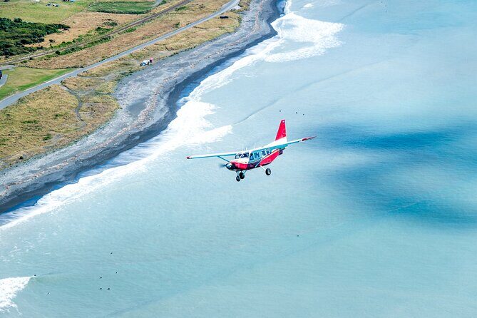
As the plane descends, you’ll head toward the Hapuku river mouth, and that sets up one of the easiest visual “targets” in the route. The flight then follows along the black sand beach toward the Kaikoura Peninsula. This is one of those features that looks almost too distinct once you see it from above.
Why it’s worth it: black sand creates high contrast against the ocean, so you can often track it even when visibility isn’t perfect. From a ground viewpoint, it can be harder to connect the beach with the nearby cliffs and bends. From the air, it’s almost like a highlighter across the coastline.
Also, watching the river mouth from above is useful. You can often see where freshwater meets the sea, how the shoreline curves, and how the peninsula’s shape starts to dominate the view. It’s the kind of geographical “aha” that sticks long after the flight ends.
Kaikoura Peninsula Seal Country From Above
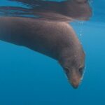
Once you’re flying around the Kaikoura Peninsula, the views get more “wildlife suspense,” because the area is described as being dotted with resident seals alongside the turquoise ocean. This is one of those details that can make the flight feel extra rewarding—even if you don’t see anything else, you still get a sense of where marine life concentrates.
The practical advice here is to treat it like a game. Don’t stare at one spot for too long. Sweep your eyes along the coast edges and calmer-looking patches of water where seals might rest close to shore. And remember: sea, light, and distance all affect what’s visible. If the ocean is bright and the coastline is crisp, sightings can feel immediate. If clouds roll in, they can mute contrast, but you might still make out shapes.
The best part is that you’re not doing a long wait for this moment. In a single short circuit, you get the geology, the coastline, and the wildlife potential without turning it into a full-day quest.
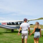
Pilot Commentary, Group Size, and the Feel of Air Kaikoura
A big part of why this flight lands well is the human factor. The information you get from the pilot matters because it turns “cool views” into “I understand what I’m seeing.” One of the pilots named in trip feedback is Tim, noted for being friendly and sharing interesting, informative details during the flight.
That pilot talk is especially helpful on a short experience like this. You don’t have time to figure everything out yourself, so hearing what features you’re passing makes the minutes count. It also helps you spot things that aren’t obvious at first—like the earthquake-related terrain changes or the specific coastline sections the pilot is tracking.
Then there’s the group size. With a maximum of 7 travelers, you’ll have more space in the flow of check-in and boarding. It also keeps the atmosphere calm. Short flights can feel hectic in crowded groups; a smaller cap usually makes the whole thing smoother.
Price and Value: Why $108.60 Can Make Sense
At $108.60 per person for about 25 minutes, this is not the cheapest way to see Kaikoura. But for what you’re buying, the value can be real. You’re paying for the perspective change that otherwise takes hours of driving and hiking—or still won’t give you the same “mountains + coastline at once” view.
Also, the trip is described as offering group discounts. That’s a common sweet spot: if you’re traveling with a couple of people who can share the same slot, the value can feel better fast. The experience is also typically booked about 45 days in advance, which is a sign that the dates can fill—especially when weather is good.
One practical way to think about it: if you only have a short window in Kaikoura, this kind of aerial overview is a smart use of time. If you already plan to spend days doing viewpoints by car or on foot, this flight becomes the “missing piece” that connects everything into one coherent picture.
Weather Reality: What to Do With Cloudy Conditions
This is an experience that requires good weather. That’s not a small detail—it’s the difference between sharp coast contours and a soft blur. The upside is that you’re not always forced into a “perfect day or nothing” mindset. One flight report described the experience as still being worth it even when skies were cloudy.
Here’s how to interpret that for your decision: even with cloud, you may still see shapes of coastlines, the general outline of peninsula and ranges, and the major features like river mouths and beach color contrast. You just might not get the same crisp mountain sparkle you’d see in clear conditions.
If you’re flexible, that helps. Weather-dependent tours often work best when you don’t have an ironclad schedule.
Getting There in Peketā: Check-In and What Happens at the End
You meet at 627 State Highway 1, Peketā 7374. Check in 30 minutes prior to your flight time, because this is a small-operation setup and they need time for boarding and final checks.
Also note the flight ends back at the meeting point. That matters more than it sounds. You won’t be stuck figuring out transport right after landing—you’re already set up in the same area.
One more practical tip: if your travel plans involve arriving by cruise or tender transfer, it’s worth asking ahead about how they coordinate getting you back after the flight. In at least one set of trip feedback, an operator arranged a return toward a ship tender area after the flight. That’s not something you should assume for every day, but it’s the right kind of detail to confirm.
Who Should Book This Scenic Flight (and Who Might Want a Plan B)
This works best if you want quick, high-value scenery and you like seeing geography from above. It’s also a good match if you want both alpine and coastal views without hopping between viewpoints all day.
It’s described as suitable for most people, and service animals are allowed. That’s a plus for travelers who need that flexibility. The one clear limitation to take seriously is weight: if you’re over 120 kg, you’re asked to contact the operator ahead of time. The information provided says refunds aren’t available if someone arrives and exceeds the weight limits, so a quick call in advance is the safest move.
Finally, because the flight is about 25 minutes, it isn’t a substitute for a full day of activities. Think of it as the “wow-fast overview” that you can pair with seaside walks or short sightseeing stops on the ground.
Should You Book This Kaikoura Coastal and Alpine Flight?
I’d book it if you want a short, focused experience that gives you a real sense of Kaikoura’s shape: mountains right up against the sea, earthquake-caused changes you can spot in the air, and the chance to see resident seals near the peninsula.
I’d hesitate only if you’re traveling with very fixed timing and can’t handle weather delays, or if you’re outside the weight guidelines and haven’t checked with the operator first. Otherwise, this is the kind of flight that helps you understand the region in one go—and then makes your ground time make sense.
If you’re deciding between “more time on the ground” and “one aerial perspective that ties it all together,” this is a strong choice.
FAQ
How long is the flight?
The flight is approximately 25 minutes.
What does the scenic flight cost?
It costs $108.60 per person.
Where do I meet for the flight?
You meet at 627 State Highway 1, Peketā 7374, New Zealand.
What time should I arrive for check-in?
Check in 30 minutes prior to your flight time.
How many people are in the group?
The experience has a maximum of 7 travelers.
Is good weather required?
Yes. The experience requires good weather, and if it’s canceled due to poor weather, you’ll be offered a different date or a full refund.
What if I’m over 120 kg?
If you are over 120 kg, you should contact the operator in advance. Refunds aren’t available if you arrive and exceed the weight limits.
Do I get a ticket on my phone?
Yes, the experience includes a mobile ticket, and you’ll receive confirmation at the time of booking.
Can I bring a service animal?
Service animals are allowed.