REVIEW · KAIKOURA
Kaikoura: Coastal and Alpine Scenic Airplane Flight
Book on GetYourGuide →Operated by Air Kaikoura · Bookable on GetYourGuide
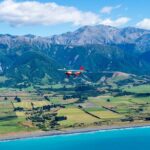
Kaikoura looks different from the sky. I like how this short flight packs coastline drama and mountain flying into one easy outing, with live narration you can actually hear through the headsets. I also love the route details: you’re not just looking out at sea—you’re flying past places like Mt Fyffe and the Kaikoura Peninsula with a bird’s-eye view of seals near the turquoise water.
One thing to keep in mind: this is weather-dependent. Even with a 100% poor weather refund, you’ll want to plan for a day that may have to wait for visibility to cooperate.
In This Review
- Key Highlights to Focus On
- Why This 25-Minute Flight Works So Well in Kaikoura
- Getting Set Up: Headsets, Small Group, and the Airport Arrival
- Climb and Turn: Flying the Seaward Kaikoura Ranges and Mt Fyffe
- Snowy Peaks, Waterfalls, and the Need for Sharp Eyes
- Lake Hapuku After the 2016 Earthquake: Seeing Change from Above
- The Black Sand Beach and the Kaikoura Peninsula Coastline
- Price and Value: Is $104 Fair for 25 Minutes in the Air?
- Who Should Book (and Who Might Want Another Option)
- Should You Book This Kaikoura Scenic Flight?
- FAQ
- How long is the Kaikoura scenic airplane flight?
- Where do I meet at Kaikoura Airport?
- Is live commentary included?
- What group size is this flight?
- Is the flight wheelchair accessible?
- Is there a weight limit?
- What happens if the weather is poor?
Key Highlights to Focus On
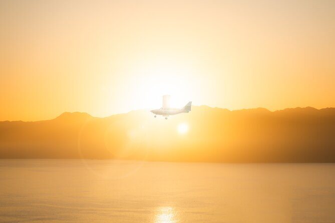
- Pilot-led live commentary you hear clearly through listening headsets
- 6000 feet climb that turns Kaikoura’s “big views” into real mountain flying
- Seaward Kaikoura ranges + Kaikoura Peninsula in one continuous loop
- Lake Hapuku views tied to the 2016 Kaikoura earthquake landscape change
- Black sand beach flight for a striking coastal contrast
- Resident seals sighting potential right by the peninsula’s coastline
Why This 25-Minute Flight Works So Well in Kaikoura
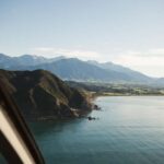
Kaikoura is one of those places where everything is close, but the scale is hard to grasp from the road. From the air, you immediately get a better read on the geography: the mountains rise hard behind the coast, the coastline curves, and the peninsula juts out like a finger into the ocean. That’s the core appeal of this 25-minute scenic flight. It’s short enough to fit almost any schedule, yet structured enough that you see multiple “worlds” without feeling rushed.
I also like the practical focus of the experience. You’re not expected to figure out where to look or guess what you’re seeing. The narration is live, and you’re given headsets for commentary, which means you can keep your eyes on the views instead of scanning the sky in silence. Past flights have included pilots such as Ben delivering the flight commentary, and guides like Tim adding context when you want that extra layer of local understanding.
Is it perfect for everyone? If you’re the type who wants lots of time on the ground—walks, viewpoints, and slow wandering—this won’t replace a full-day sightseeing plan. Think of it as a high-impact view-maker: you’ll leave with a strong mental map of Kaikoura’s coast-and-alps shape, and you’ll likely want to pair it with something else after.
You can also read our reviews of more tours and experiences in Kaikoura.
Getting Set Up: Headsets, Small Group, and the Airport Arrival
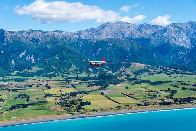
The whole experience is designed to be straightforward. You’ll spend about 1 hour total from arrival to completion, even though the flight itself is 25 minutes. That time buffer matters because aircraft operations and weather checks don’t always run like a metronome.
You’ll meet at Kaikoura Airport by turning right as you arrive and parking toward the black hangar and surrounding buildings. It’s simple, but it’s worth arriving a touch early so you can settle in before boarding.
The group is limited to 7 participants, which I consider a real advantage. Smaller groups tend to mean less crowding at the aircraft door and a calmer vibe during boarding and briefing. You also get more of that hands-on, human feel when the guide and pilot can address the group without treating it like a cattle line.
There’s also a weight consideration. This experience isn’t suitable for people over 264 lbs (120 kg). If you’re within the limit, you should feel comfortable that the setup is geared toward a manageable, passenger-friendly flight experience rather than a heavy-load route.
Climb and Turn: Flying the Seaward Kaikoura Ranges and Mt Fyffe
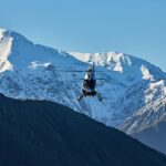
Once you take off, the flight quickly becomes more than a coastline postcard. You climb to about 6000 feet, which changes what you can see. At that height, the layers of terrain become clear: the ocean line, the peninsula shape, and the mountain backbone behind it.
A key moment is when you fly past the back of Mount Fyffe. Mountain flying from the air isn’t just a thrill; it’s also practical. It helps you understand how Kaikoura’s inland ranges shape wind and weather on the coast. From the ground, you can see mountains. From the air, you start to see how the peaks and valleys create channels and spillovers.
I also like that this isn’t only a “look at the mountains” segment. The narration is timed so you’re learning what you’re seeing as you’re seeing it, rather than getting a history lesson at the end. On some outings, pilots like Ben are highlighted for commentary that helps you orient fast, so you don’t spend the first few minutes wondering what you’re looking for.
This is where the flight earns its keep. You go beyond flat coastal views and get that alpine perspective where terrain looks sculpted. Even if the scenery isn’t perfect in the literal sense, the shape of the region still comes through.
Snowy Peaks, Waterfalls, and the Need for Sharp Eyes
Kaikoura’s altitude-driven drama shows up in the chance to see snowy mountain peaks. The details depend on conditions, but the route is planned with the “wintery” look in mind when peaks are visible.
You also might spot a waterfall or even a wild deer if you have sharp vision. That’s not something you can guarantee, and that’s precisely why it feels special when it happens. From the air, a waterfall can read like a clean white line slicing down a slope. A deer, on the other hand, is more subtle—a small moving dot against pale rock or vegetation.
Here’s my practical advice: keep your eyes moving in a slow sweep instead of staring straight down for too long. At flight speed, the best sightings tend to happen when you scan in a steady rhythm. Your headsets help too, since you can listen for cues about which direction the pilot will focus next.
And if you’re traveling with kids or anyone who gets antsy, this segment gives quick “possible highlights.” It’s not just the scenery—it’s the idea that you might catch something moving.
Lake Hapuku After the 2016 Earthquake: Seeing Change from Above
Next comes one of the most meaningful parts of the flight: overflying Lake Hapuku, which is a direct result of the 2016 Kaikoura earthquake. This is not a trivia stop. It’s a reminder that the land is active, and the shape you see today is sometimes the result of sudden change.
From the air, earthquake-related landform changes are easier to interpret. Instead of thinking about it as an event from a news headline, you see the layout—water where there wasn’t water before, and how the surrounding terrain guides that new pattern.
After that, the flight descends toward the Hapuku river mouth, and you get a different kind of view: the transition from mountain-and-lake angles to the coast’s edge. This is where the flight stops feeling like sightseeing and starts feeling like a geography lesson delivered at aircraft speed.
The value here is simple. If you love understanding why places look the way they do, you’ll come away with a story you can point to on future drives. You’ll remember the coastline, but you’ll also remember what shaped it.
The Black Sand Beach and the Kaikoura Peninsula Coastline
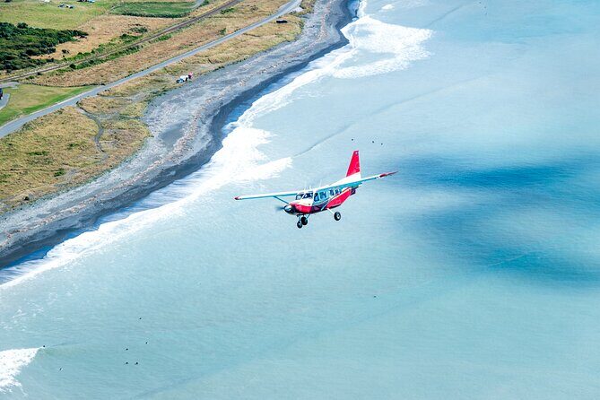
When you descend toward the Hapuku river mouth, the coastline becomes the show. The flight moves along the black sand beach, which is a striking contrast against the brighter ocean colors you’ll see elsewhere along the route. It’s one of those visual cues that makes Kaikoura feel instantly distinctive.
Then you start circling around the Kaikoura Peninsula, where the coastline’s curves and angles become clearer at every turn. This is also the stage where the ocean starts to look like more than a background. You’ll see how the peninsula changes where swell lines meet shore.
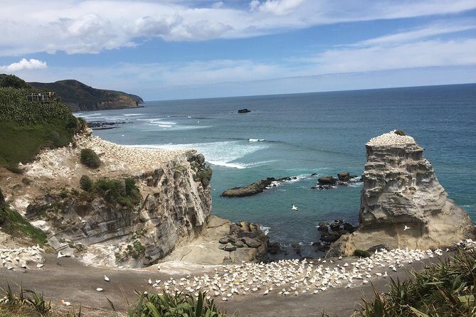
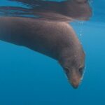
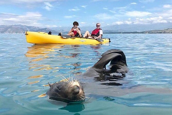
And yes, this is where seals come into the picture. The peninsula is dotted with resident seals next to the turquoise ocean. That combination—coastline shape plus wildlife near shore—is why people love flying this route. From the ground, you might hear about seals. From the air, you can understand the where and why: which parts of the coast are exposed, which sections are sheltered, and where seals hang out along the shoreline.
One more practical thing: take photos from both sides if you can. The pilot’s positioning can affect the exact angles. Even with good visibility, the best seal views can be brief, so having your phone or camera ready before the turn is a smart move.
Price and Value: Is $104 Fair for 25 Minutes in the Air?
At $104 per person for a 25-minute scenic flight, this is not a budget activity, but it doesn’t feel like a splurge without purpose either. The value comes from time efficiency and viewpoint payoff.
From the road, you can spend time driving between viewpoints and still miss the full story of Kaikoura’s coastal-and-alpine setup. This flight compresses that learning. You get multiple “chapters” of scenery—mountain flying, earthquake-landscape change, black sand coastline, and resident seals—without needing to plan a whole day of stops.
Also, the small group size (up to 7) helps justify the price for me. It keeps the experience personal enough that you feel like part of the journey, not a passenger in a line. The headsets with live commentary add another layer of value because you’re not just watching; you’re interpreting while you watch.
If you’re the type who loves photos, this is one of those rare occasions where the cost can feel justified quickly. You’ll likely come away with shots that would be hard to recreate from ground viewpoints.
Who Should Book (and Who Might Want Another Option)
This flight makes the most sense if you want a high-view, low-hassle experience. You’ll probably enjoy it most if:
- You like scenery that shows both coast and alpine in one shot
- You want a quick way to get your bearings around Kaikoura’s shape
- You care about live commentary, not just passive sightseeing
- You’re trying to pack in a special activity without losing a full day
It may be less ideal if:
- You need a lot of time outdoors for walking and lingering
- You dislike anything dependent on visibility (weather matters)
- You’re over the weight limit of 264 lbs (120 kg)
If you’re already thinking about other Kaikoura wildlife experiences, this flight can be a great “warm-up.” One of the reviews you’ll likely echo in your own decisions is the idea that after seeing the coastline from above, you’ll want to pair it with a marine outing. It’s a natural follow-on if you’re staying in the area for a few days.
Should You Book This Kaikoura Scenic Flight?
I think you should book this if you want a fast, memorable Kaikoura overview with strong narration and real variety in scenery. The route hits the key visual themes people came to Kaikoura for—mountains and coast—then adds meaning with Lake Hapuku tied to the 2016 earthquake and the dramatic black sand beach.
Skip it only if your travel style is built around long ground time, or if you know you’re likely to be frustrated by weather-driven uncertainty. Even then, the 100% poor weather refund makes the risk feel less harsh, since you’re not left holding the bag if visibility doesn’t cooperate.
For most visitors, this is one of those experiences that earns its place near the top of your South Island plan. You’ll come away with images and a mental map that makes the rest of Kaikoura easier to understand.
FAQ
How long is the Kaikoura scenic airplane flight?
The flight itself is 25 minutes. You should allow about 1 hour total for the whole experience.
Where do I meet at Kaikoura Airport?
When you arrive at Kaikoura Airport, turn right and park toward the black hangar and buildings.
Is live commentary included?
Yes. You’ll have listening headsets for live commentary during the flight, with English support (live tour guide and audio guide included in English).
What group size is this flight?
It’s a small group limited to 7 participants.
Is the flight wheelchair accessible?
Yes. This experience is wheelchair accessible.
Is there a weight limit?
Yes. It is not suitable for people over 264 lbs (120 kg).
What happens if the weather is poor?
There is a 100% poor weather refund.