REVIEW · ROTORUA
Rotorua: Scenic Flight over Mt Tarawera & Waimangu Valley
Book on GetYourGuide →Operated by Volcanic Air · Bookable on GetYourGuide
A floatplane flight over Rotorua is the quickest wow-factor. You’ll take off and land on the water, then fly a tight circuit over Mt Tarawera and the geothermal valleys that make this corner of New Zealand famous. I especially like the chance to see the crater rift line and the 1886 eruption clues from above, and I also love how your guide/pilot gives context while the views roll by. One possible drawback: the whole experience is weather dependent, so you may not get the full route if visibility is poor or conditions change.
You get about 30 minutes actually in the air during a total 40-minute outing, with a small group capped at 10 people. Expect a real safety briefing before takeoff, then a guided, photo-focused flight that includes Rotorua’s lakes, volcanic terrain, and major geothermal sights. The biggest consideration is for anyone worried about heights or altitude symptoms, because this is an aerial tour with no slow, grounded viewing break.
In This Review
- Key Highlights You’ll Care About
- Why a Rotorua Floatplane Beats the Usual Tours
- Meeting at the Rotorua Lakefront: What the Start Feels Like
- The Water Takeoff: The Moment It Becomes Real
- Rotorua’s 13 Lakes from Above (and Why It Matters)
- Mt Tarawera: The 3680-Foot Volcano and the 1886 Story
- Waimangu Thermal Valley: Inferno Crater and Frying Pan Lake
- Coming Back: Whakarewarewa, Pohutu Geyser, and City Views
- Price and Value: Is $236 Worth It?
- Weather Rules and Real-Life Expectations (What Can Change)
- Who This Floatplane Flight Fits Best
- The Simple Packing List That Helps
- Should You Book This Flight or Skip It?
- FAQ
- How long is the overall experience?
- How much time is spent flying?
- What’s the price per person?
- Where do we meet for check-in?
- Is there a guide on the flight?
- Are window seats guaranteed?
- Is the tour guaranteed to run in any weather?
- Are bags allowed?
- Is this suitable for people using wheelchairs?
- What should I bring (and what shouldn’t I bring)?
Key Highlights You’ll Care About
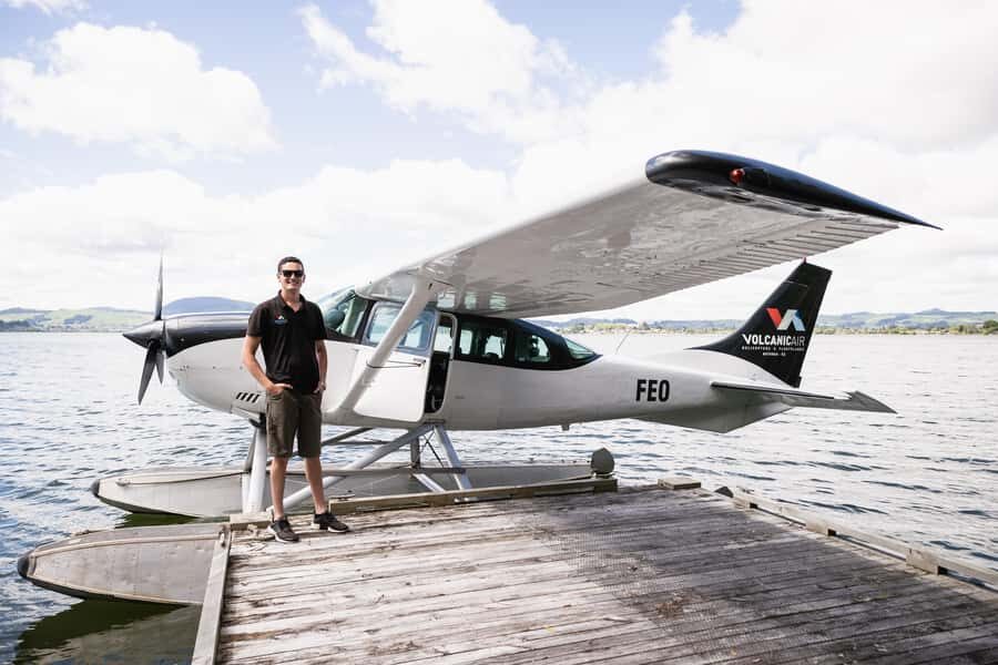
- Floatplane water takeoff and landing right on Lake Rotorua
- Window seats for all passengers so you’re not stuck looking at elbows and hats
- Mt Tarawera crater rift line view from the air (the same 1886 story, seen clearly)
- Waimangu Thermal Valley flyover with Inferno Crater and Frying Pan Lake
- Clear guided interpretation from your English-speaking pilot/guide during the flight
Why a Rotorua Floatplane Beats the Usual Tours
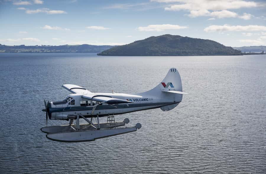
Rotorua is built for geothermal sightseeing, but from the ground it can feel like you’re ticking off spots. This flight changes the angle entirely. In a short time, you get a big-picture view of how the lakes, volcano ridges, and thermal valleys fit together.
I like that it’s not just scenery-for-scenery’s-sake. The pilot’s explanations tie what you see to the volcanic events that shaped the area, including the eruption that devastated local landmarks such as the Pink and White Terraces. If you enjoy understanding how a place works, this format delivers.
Still, keep your expectations aligned with the time. You’re not doing a long aerial loop for hours. You’re getting a focused, high-impact 40 minutes with a schedule that can flex for weather and visibility.
You can also read our reviews of more tours and experiences in Rotorua.
Meeting at the Rotorua Lakefront: What the Start Feels Like
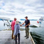
You’ll check in at the operator’s office building on Lakefront Drive and look for their large roof signs. Plan on arriving a little early so you’re not rushed when it’s time for the safety briefing.
Before anything lifts off, you’ll get a 20-minute safety briefing, which matters on a floatplane. This is also the moment when you’ll get your bearings—how boarding works, where to place items (and that you can’t bring bags), and what the flight will feel like.
If you like taking photos, this is the time to decide quickly how you want to shoot. Once you’re airborne, you’ll be reacting to moments, not fiddling with your gear.
The Water Takeoff: The Moment It Becomes Real
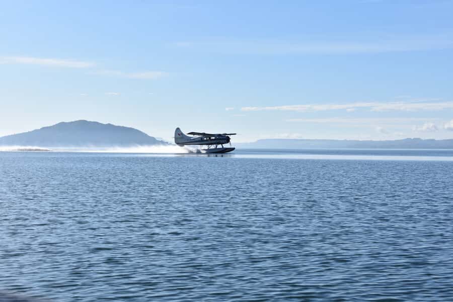
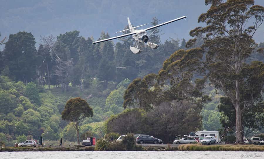
The first thrill is the floatplane takeoff and landing on Lake Rotorua. It’s not a metaphor. You feel the water, the lift, and the shift from “waiting” to “flying” in a way that feels more personal than a big airplane.
After takeoff, you climb around Mokoia Island and head toward the ridge and the lakes district. The altitude comes on gradually, so you get time to settle in and start framing shots without feeling like everything happens at once.
From what you can reasonably expect, the experience is designed for good visibility. One nice detail: window seats are arranged so everyone can see out and take pictures.
Rotorua’s 13 Lakes from Above (and Why It Matters)
Once you’re up, Rotorua’s famous lake system stops being a map idea and becomes a pattern. You’ll see multiple lakes spread across the region, with native New Zealand bush and volcanic features forming the borders.
This is where the flight adds value beyond standard sightseeing. Aerial views help you understand how many of Rotorua’s geothermal zones relate to the underlying geology and volcanic structures. Even if you’ve driven through the area before, seeing the “why” from above is a different kind of education.
Bring warm layers too. Even when the day looks mild on the ground, air movement near the water and at altitude can cool you quickly. A camera helps, but warmth helps you enjoy the whole circuit without constantly adjusting clothing.
Mt Tarawera: The 3680-Foot Volcano and the 1886 Story
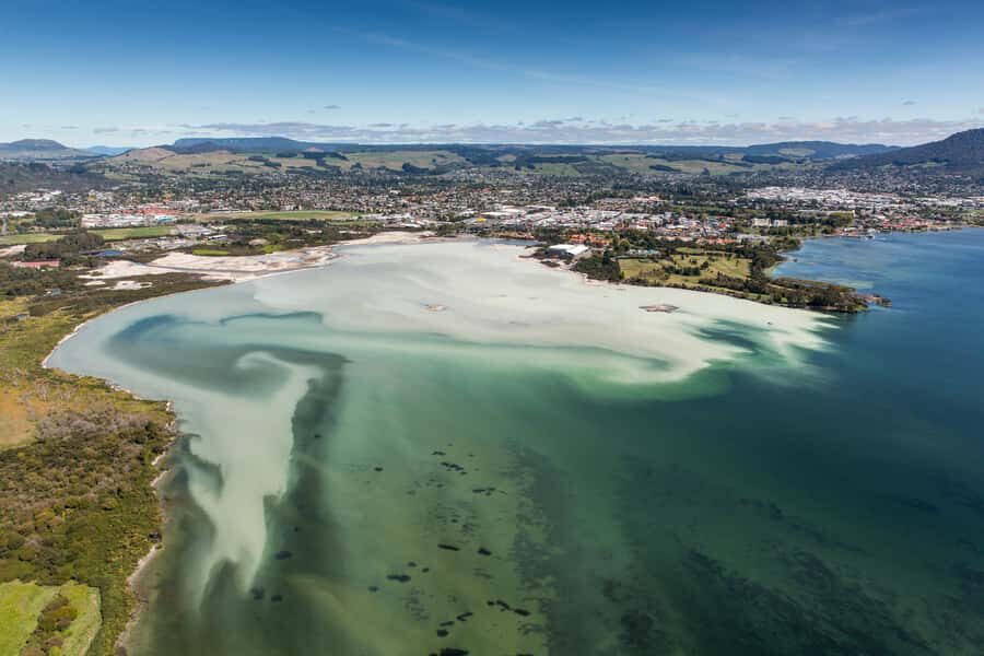
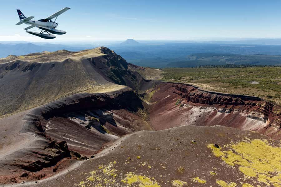
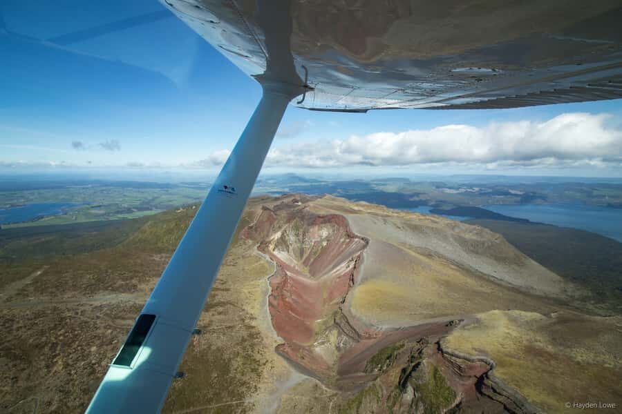
The main event is Mt Tarawera, which sits at about 3,680 feet and dominates the surrounding area. As you approach, you’ll fly over the volcanic peaks and get a direct look at the crater and the darker rift features.
Your pilot will take you over the 8 km crater rift line linked to the largest eruption in New Zealand’s living memory: the 1886 eruption. From the air, the story feels more concrete than a brochure description. You can actually see the geometry of the volcanic disruption rather than just hearing about it.
You’ll also learn how that eruption devastated the local area and affected the famous Pink and White Terraces, once described as the eighth wonder of the world. The flight doesn’t just point to the past—it connects it to the present-day geothermal landscape you’re flying over.
If you’re a photo person, this is the section where you’ll want to be ready. Light can shift fast, and craters show best when you’re quick with your framing.

Waimangu Thermal Valley: Inferno Crater and Frying Pan Lake
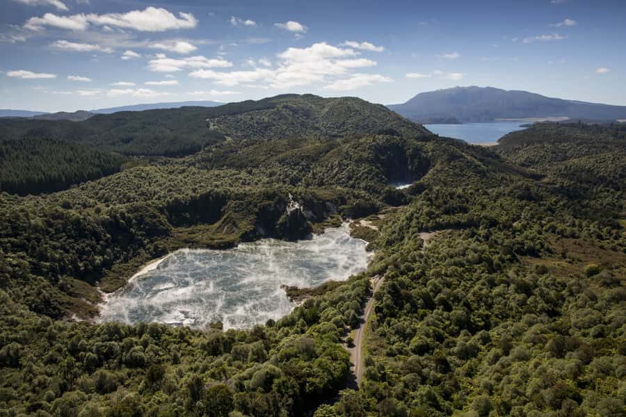
After Tarawera, you move into the Waimangu Thermal Valley airspace. This is where the geothermal character gets more intense visually, even from several kilometers up.
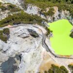
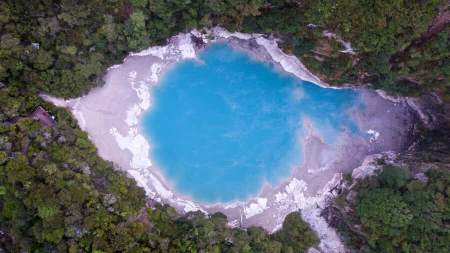
You’ll fly over the Inferno Crater and Frying Pan Lake during the segment, with views that help you appreciate how thermal activity shapes color and texture. It’s the kind of view that makes you understand why people call Rotorua geothermal country instead of just a tourist region.
Just note that thermal areas can be sensitive to weather and visibility. Mist, low cloud, or heavy wind can soften the look of craters and thermal contrasts. That’s one reason the operator may alter the route if conditions aren’t safe or the views aren’t clear.
Coming Back: Whakarewarewa, Pohutu Geyser, and City Views
The return approach gives you another useful angle. You’ll pass the Whakarewarewa Thermal Valley and Pohutu Geyser, then fly over Rotorua city before landing back on Lake Rotorua.
This part is great if you like the contrast between geothermal power and everyday life. From the air, you see how close the geothermal zones are to neighborhoods and roads—proof that the ground under Rotorua is active in more ways than one.
Landing is the same thrill as takeoff, just in reverse. The floatplane touches water smoothly, and the whole thing ends quickly enough that you’re already planning a second look before you’ve even stepped away.
Price and Value: Is $236 Worth It?
At $236 per person for a 40-minute experience (with around 30 minutes flying), it’s not a budget activity. But value in Rotorua isn’t only about price—it’s about how much you can see without losing the plot.
For the money, you’re buying three things that are hard to get otherwise:
1) a true aerial perspective over Tarawera and the crater rift line,
2) flyovers of major geothermal zones like Waimangu and Whakarewarewa, and
3) quick, guided interpretation that helps you understand what you’re looking at.
If you’re only doing one premium attraction in Rotorua, this one makes sense because it compresses a lot of geology into a short time. If you’re trying to fill every day with activities, you may feel the cost more, since you’re paying for views rather than hours.
Weather Rules and Real-Life Expectations (What Can Change)
This is a weather-dependent tour. If it isn’t safe, or if the operator can’t get views they expect you to see, the flight may not go ahead or may not follow the exact route you hoped for.
That matters because geothermal regions can hide behind cloud, haze, or rain. In at least one situation, people have still managed to get up and see some of the local scenery even when the full circuit wasn’t possible—and the timing stayed tight.
Also remember: tour duration and exact flight times can vary due to volcanic activity and passenger loading. It’s short by design, but it’s not a “guaranteed perfect loop” product.
Who This Floatplane Flight Fits Best
This flight is best for people who want the big picture fast and don’t mind being hands-on during a short window of flying.
It’s likely a strong match if you:
- love aerial photography and want window views during the whole flight
- enjoy learning how geology connects to what you see on the ground
- want a high-impact Rotorua activity without adding hours of driving
It may not fit if you:
- use a wheelchair (not suitable per the activity info)
- are afraid of heights
- have altitude sickness concerns
A small personal note from one passenger experience: pilot Ben was patient and helpful getting a passenger into and out of the plane, which is a reminder that the crew can be attentive. Still, if you have specific mobility or health needs, ask directly what can be supported, and don’t assume wheelchair access is possible.
The Simple Packing List That Helps
Keep it easy. You should bring a camera and warm clothing. Light layers help, and warm basics matter because the air at altitude and near open water can feel colder than you expect.
Also, bags aren’t allowed, so travel light. If you need essentials, plan them as small personal items you can manage without luggage.
Should You Book This Flight or Skip It?
Book it if you want Rotorua’s geothermal story told with the best possible viewpoint: from above. The floatplane water takeoff/landing, the quick shot at Mt Tarawera, and the flyover of Waimangu and Pohutu Geyser make this one of the most efficient ways to get “wow” plus context.
Skip it if weather variability would stress you out, or if heights and potential symptoms are a concern. Also skip it if you prefer long, ground-level time with lots of stops, since this is a tight, time-limited aerial experience.
If your main goal is to see how the lakes and volcanoes connect—and you’re okay paying for that perspective—this is the kind of activity you’ll remember long after you leave Rotorua.
FAQ
How long is the overall experience?
The experience is 40 minutes total.
How much time is spent flying?
About 30 minutes is flying time.
What’s the price per person?
The price listed is $236 per person.
Where do we meet for check-in?
You check in at the office building on Lakefront Drive and look for the large roof signs.
Is there a guide on the flight?
Yes. There is a live English guide and an English audio guide included.
Are window seats guaranteed?
The flight is set up for window seating for all passengers.
Is the tour guaranteed to run in any weather?
No. It’s weather dependent, and it will not go ahead if it’s not safe or if views can’t be seen.
Are bags allowed?
No, bags are not allowed.
Is this suitable for people using wheelchairs?
No, it’s not suitable for wheelchair users.
What should I bring (and what shouldn’t I bring)?
Bring a camera and warm clothing. Don’t bring bags.